Area Overview for HP12 4AU
Photos of HP12 4AU
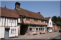
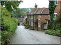
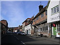

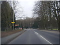
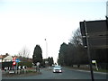
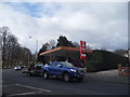
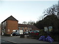
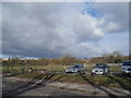
75 photos from this area
Area Information
Key information about the HP12 4AU including its size, population, and administrative classification.
- Area Type
- Postcode
- Area Size
- 4878 m²
- Population
- 1349
- Population Density
- 255 people/km²
House Prices in HP12 4AU
26
Properties
£218,758
Average Sold Price
£55,000
Lowest Price
£377,500
Highest Price
Showing 26 properties
| Address | Type | Beds | Baths | Last Sale Price | Last Sale Date | |
|---|---|---|---|---|---|---|
| 13 Portway Drive, High Wycombe, HP12 4AU | house | 2 | 1 | £306,000 | Jan 2025 | |
| 16 Portway Drive, High Wycombe, HP12 4AU | Terraced | 2 | 1 | £310,000 | Sep 2024 | |
| 14 Portway Drive, High Wycombe, HP12 4AU | house | 2 | - | £333,000 | Jan 2022 | |
| 5 Portway Drive, High Wycombe, HP12 4AU | Flat | - | - | £225,000 | Aug 2021 | |
| 22 Portway Drive, High Wycombe, HP12 4AU | house | - | - | £283,000 | Jun 2021 | |
| 17 Portway Drive, High Wycombe, HP12 4AU | Terraced | 2 | 1 | £282,000 | May 2020 | |
| Riverside House, 25A Portway Drive, High Wycombe, HP12 4AU | Terraced | 3 | 2 | £377,500 | Sep 2019 | |
| 23 Portway Drive, High Wycombe, HP12 4AU | Terraced | 2 | 1 | £250,000 | May 2019 | |
| 24 Portway Drive, High Wycombe, HP12 4AU | Terraced | 2 | 1 | £264,000 | Nov 2018 | |
| 15 Portway Drive, High Wycombe, HP12 4AU | Terraced | 2 | 1 | £275,000 | Feb 2016 |
Page 1 of 3
Energy Efficiency in HP12 4AU
Amenities
Schools
| Rank | School | Type | Entry gender | Ages |
|---|
Explore more schools in this area
Go to Schools tabDemographics
Household Size
Two person
most common
Accommodation Type
Houses
most common
Tenure
71
majority
Ethnic Group
White
most common
Religion
N/A
most common
Household Composition
N/A
most common
Age
47
median
Adults (30-64 years)
most common
Household Deprivation
N/A
with no deprivation
NS-SEC
45
in Lower managerial occupations
Explore more demographic insights in this area
Go to Demographics tabPlanning
Planning Constraints
- Flood RiskPremium
- Ramsar Wetland SitesPremium
- Area of Outstanding Natural BeautyPremium
- Protected Nature ReservePremium
- Protected WoodlandPremium