Area Overview for HP12 4AT
Photos of HP12 4AT
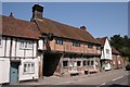
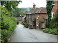
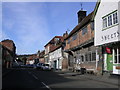
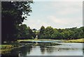
75 photos from this area
Area Information
Key information about the HP12 4AT including its size, population, and administrative classification.
- Area Type
- Postcode
- Area Size
- 5982 m²
- Population
- 1349
- Population Density
- 255 people/km²
House Prices in HP12 4AT
22
Properties
£201,030
Average Sold Price
£73,000
Lowest Price
£371,000
Highest Price
Showing 22 properties
| Address | Type | Beds | Baths | Last Sale Price | Last Sale Date | |
|---|---|---|---|---|---|---|
| 41 Portway Drive, High Wycombe, HP12 4AT | Flat | 2 | 1 | £236,000 | Sep 2025 | |
| 37 Portway Drive, High Wycombe, HP12 4AT | Semi-detached | 2 | 1 | £342,500 | Apr 2023 | |
| 43 Portway Drive, High Wycombe, HP12 4AT | Flat | 2 | 1 | £200,000 | Jun 2022 | |
| 40 Portway Drive, High Wycombe, HP12 4AT | Flat | - | - | £230,000 | Jun 2021 | |
| 38 Portway Drive, High Wycombe, HP12 4AT | Flat | - | - | £248,000 | Jan 2019 | |
| 45 Portway Drive, High Wycombe, HP12 4AT | Flat | - | - | £255,000 | Sep 2016 | |
| 33 Portway Drive, High Wycombe, HP12 4AT | Semi-detached | 4 | 1 | £371,000 | Aug 2016 | |
| 26 Portway Drive, High Wycombe, HP12 4AT | Flat | 3 | 1 | £212,500 | Mar 2013 | |
| 46 Portway Drive, High Wycombe, HP12 4AT | Flat | - | - | £159,000 | Mar 2011 | |
| 29 Portway Drive, High Wycombe, HP12 4AT | Terraced | - | - | £191,000 | Mar 2006 |
Page 1 of 3
Energy Efficiency in HP12 4AT
Amenities
Schools
| Rank | School | Type | Entry gender | Ages |
|---|
Explore more schools in this area
Go to Schools tabDemographics
Household Size
Two person
most common
Accommodation Type
Houses
most common
Tenure
71
majority
Ethnic Group
White
most common
Religion
N/A
most common
Household Composition
N/A
most common
Age
47
median
Adults (30-64 years)
most common
Household Deprivation
N/A
with no deprivation
NS-SEC
45
in Lower managerial occupations
Explore more demographic insights in this area
Go to Demographics tabPlanning
Planning Constraints
- Flood RiskPremium
- Ramsar Wetland SitesPremium
- Area of Outstanding Natural BeautyPremium
- Protected Nature ReservePremium
- Protected WoodlandPremium