Area Overview for HP11 1BB
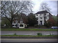
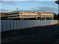
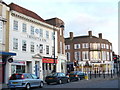
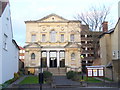
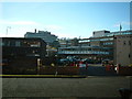
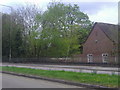
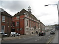
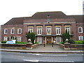
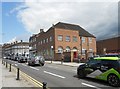
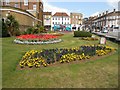
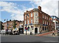
Photos of HP11 1BB

Area Information
HP11 1BB is a compact residential postcode in England, covering 8,219 square metres and home to 2,359 residents. Its high population density of 2,349 people per square kilometre reflects a tightly knit community, typical of small urban clusters. The area’s character is shaped by its proximity to transport networks and local amenities, making it a practical choice for those prioritising connectivity. While the housing stock is predominantly flats, the area’s small size means residents are likely to know their neighbours. The presence of nearby railway stations and a nearby independent school suggests a focus on accessibility for families and commuters. However, the area’s challenges—such as high flood risk and above-average crime rates—demand careful consideration for prospective buyers. Despite these factors, HP11 1BB offers a blend of convenience and proximity to services, appealing to those seeking a compact, well-served environment.
- Area Type
- Postcode
- Area Size
- 8219 m²
- Population
- 2359
- Population Density
- 2349 people/km²
The property market in HP11 1BB is characterised by a low home ownership rate of 37%, with flats making up the majority of housing stock. This suggests the area is more rental-oriented than owner-occupied, likely due to its small size and limited land availability. The concentration of flats may appeal to those seeking affordable, manageable living spaces, but it also means competition for properties could be fierce. Buyers should consider the area’s constraints—its compact footprint and proximity to transport—when evaluating long-term value. The lack of larger homes or detached properties indicates this is not a market for those seeking expansive living spaces. For investors, the rental demand may be steady, but the risk factors, such as flood and crime concerns, could impact property desirability.
House Prices in HP11 1BB
Showing 7 properties
Energy Efficiency in HP11 1BB
Residents of HP11 1BB have access to a range of local amenities within practical reach. Retail options include Iceland High, Tesco High, and M&S Eden, providing everyday shopping convenience. The area’s rail connections to High Wycombe, Bourne End, and Marlow stations facilitate easy travel to nearby towns and cities. Wycombe Air Park offers regional air travel access, though its role in daily life is less defined. While the data does not mention parks or leisure facilities, the proximity to rail and retail suggests a focus on practicality over expansive recreational spaces. The compact nature of the area means amenities are closely clustered, supporting a convenient, if limited, lifestyle for residents.
Amenities
Schools
The nearest school to HP11 1BB is Wycombe Abbey, an independent school noted for its academic standards. While no Ofsted rating is provided, the presence of a high-quality independent school may attract families seeking private education. However, the area’s limited school options—only one listed—suggest a reliance on nearby institutions for public education. This could be a concern for families prioritising a range of school types or those requiring proximity to multiple educational institutions. The absence of additional schools in the data implies that residents may need to travel beyond the immediate area for alternative schooling options.
| Rank | School | Type | Entry gender | Ages |
|---|
Explore more schools in this area
Go to Schools tabDemographics
The population of HP11 1BB is dominated by adults aged 30–64, with a median age of 22, indicating a mix of young professionals and middle-aged residents. Home ownership here is relatively low at 37%, suggesting a higher proportion of renters, possibly due to the prevalence of flats. The accommodation type—flats—aligns with the area’s density and limited space. The predominant ethnic group is White, though no specific data on diversity or deprivation is provided. The age profile suggests a community with a balance of established residents and younger individuals, potentially influencing local amenities and services. The high population density may contribute to a lively, compact social environment, though it also raises questions about housing availability and long-term stability for buyers.
Household Size
Accommodation Type
Tenure
Ethnic Group
Religion
Household Composition
Age
Household Deprivation
NS-SEC
Explore more demographic insights in this area
Go to Demographics tabPlanning
Planning Constraints
- Flood RiskPremium
- Ramsar Wetland SitesPremium
- Area of Outstanding Natural BeautyPremium
- Protected Nature ReservePremium
- Protected WoodlandPremium