Area Overview for HP10 8AZ
Photos of HP10 8AZ
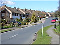
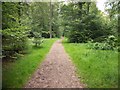
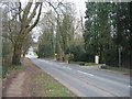
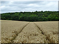
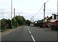
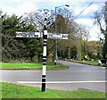
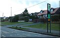
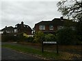
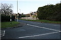
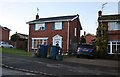
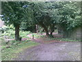

26 photos from this area
Area Information
Key information about the HP10 8AZ including its size, population, and administrative classification.
- Area Type
- Postcode
- Area Size
- 1.5 hectares
- Population
- 1473
- Population Density
- 4593 people/km²
House Prices in HP10 8AZ
24
Properties
£449,844
Average Sold Price
£91,000
Lowest Price
£750,000
Highest Price
Showing 24 properties
| Address | Type | Beds | Baths | Last Sale Price | Last Sale Date | |
|---|---|---|---|---|---|---|
| 61 Ashley Drive, Tylers Green, HP10 8AZ | Semi-detached | 4 | 2 | £713,000 | Aug 2025 | |
| 76 Ashley Drive, Tylers Green, HP10 8AZ | Semi-detached | 3 | 1 | £630,000 | Sep 2024 | |
| 73 Ashley Drive, Tylers Green, HP10 8AZ | Semi-detached | 3 | - | £532,000 | Jan 2023 | |
| 53 Ashley Drive, Tylers Green, HP10 8AZ | Semi-detached | 4 | - | £750,000 | Jul 2021 | |
| 58 Ashley Drive, Tylers Green, HP10 8AZ | house | - | - | £635,000 | Mar 2021 | |
| 64 Ashley Drive, Tylers Green, HP10 8AZ | Semi-detached | 4 | 2 | £525,000 | Dec 2018 | |
| 62 Ashley Drive, Tylers Green, HP10 8AZ | house | - | - | £575,000 | Feb 2018 | |
| 69 Ashley Drive, Tylers Green, HP10 8AZ | Semi-detached | 3 | 2 | £510,000 | Nov 2017 | |
| 70 Ashley Drive, Tylers Green, HP10 8AZ | Semi-detached | 6 | 2 | £393,000 | Jun 2013 | |
| 68 Ashley Drive, Tylers Green, HP10 8AZ | Semi-detached | - | - | £382,500 | Apr 2013 |
Page 1 of 3
Energy Efficiency in HP10 8AZ
Amenities
Schools
| Rank | School | Type | Entry gender | Ages |
|---|
Explore more schools in this area
Go to Schools tabDemographics
Household Size
Family (3-5 people)
most common
Accommodation Type
Houses
most common
Tenure
85
majority
Ethnic Group
White
most common
Religion
N/A
most common
Household Composition
N/A
most common
Age
47
median
Adults (30-64 years)
most common
Household Deprivation
N/A
with no deprivation
NS-SEC
45
in Lower managerial occupations
Explore more demographic insights in this area
Go to Demographics tabPlanning
Planning Constraints
- Flood RiskPremium
- Ramsar Wetland SitesPremium
- Area of Outstanding Natural BeautyPremium
- Protected Nature ReservePremium
- Protected WoodlandPremium