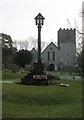
Area Overview for Horndean
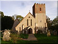
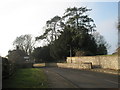
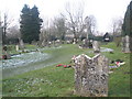
Photos of Horndean

Area Information
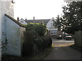
Living in Horndean offers a grounded community experience within a defined civil parish covering 18.2 km². The population stands at 5,418 residents, creating an intimate residential scale that avoids the density of larger towns. You will find a neighbourhood character shaped by this modest population size, resulting in a manageable environment where local connections often run deeper than in sprawling urban centres. The area functions as a quiet retreat from the wider Hampshire landscape while remaining accessible to broader transport networks. Daily life here centres on a settled pace, supported by a community that has grown steadily over time. There are no administrative complexities regarding planning constraints such as Ramsar wetlands or Areas of Outstanding Natural Beauty, providing clarity on future development potential. While the parish boundary encloses specific protected woodlands worth noting, the overall footprint supports a lifestyle defined by stability rather than rapid expansion. Prospective buyers seeking a homes in Horndean find an established setting where the relationship between residents and the immediate surroundings remains personal and direct.
- Area Type
- Parish
- Area Size
- 18.2 km²
- Population
- 5418
- Population Density
- 298 people/km²
Demographics
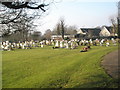
The community in Horndean reflects a mature demographic profile distinct from younger urban zones. The median age of 70 years confirms that the population consists primarily of older residents, shaping the social fabric and local service needs. Home ownership levels reach 83%, indicating a population deeply invested in their local properties and unlikely to move frequently. This high rate of ownership correlates with the age profile, as retired adults often prefer the stability of staying put. Household composition and accommodation type statistics are recorded for the parish as a whole, though specific breakdowns by tenure or family unit type are not explicitly detailed beyond the total population count. You can expect a neighbourhood where long-term residents dominate the housing stock, fostering a sense of continuity across generations. The lack of significant youth inflow suggests limited new-build family estates, pointing instead to a stock dominated by established dwellings. Ethnic diversity and religious affiliation data are noted for the total population, but the dominant narrative of the area remains one of age and stability rather than shifting demographic waves.
Household Size
Accommodation Type
Tenure
Ethnic Group
Religion
Household Composition
Age
Household Deprivation
NS-SEC
Explore more demographic insights in this area
Go to Demographics tabPlanning
Planning Constraints
- Flood RiskPremium
- Ramsar Wetland SitesPremium
- Area of Outstanding Natural BeautyPremium
- Protected Nature ReservePremium
- Protected WoodlandPremium
- Crime RiskPremium