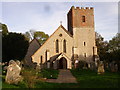
Area Overview for Catherington
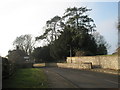
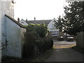
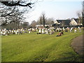
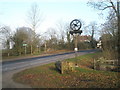
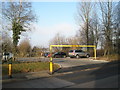
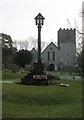
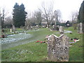
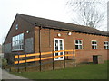
Photos of Catherington
Area Information
Catherington is a compact built-up area in England, covering 33.7 hectares. It is a place where daily life is shaped by its modest size and the presence of nearby amenities. The area’s population, while not specified in detail, skews older, with a median age of 70, suggesting a community of long-term residents. Living here means proximity to essential services, including retail outlets and rail links to surrounding towns. The area is served by five rail stations within practical reach, including Rowlands Castle and Havant, offering easy access to commuting routes. For families, Catherington provides a mix of state and independent schooling options, with Catherington Church of England Infant School and Kingscourt School both rated ‘good’ by Ofsted. While the area’s small footprint limits expansion, its existing infrastructure ensures a self-contained lifestyle for those prioritising convenience and accessibility.
- Area Type
- Built Up Area 250
- Area Size
- 33.7 hectares
- Population
- Not available
- Population Density
- Not available
Catherington’s lifestyle is shaped by its proximity to retail and rail amenities. Local shops include Spar, The Southern Co-operative Co, and Budgens Clanfield, offering essential goods within walking distance. The rail stations provide access to broader shopping and leisure opportunities in nearby towns. While the area lacks detailed information on parks or recreational facilities, the existing retail and transport infrastructure supports a convenient, self-contained lifestyle. The mix of retail outlets and rail links ensures residents can meet daily needs without long journeys, fostering a sense of accessibility and practicality.
Amenities
Schools
Catherington offers a range of educational options, including Catherington Church of England Infant School, a primary school rated ‘good’ by Ofsted, and Kingscourt School, an independent institution also rated ‘good’. This combination provides families with both state and private schooling choices, catering to different preferences and budgets. The presence of two schools with strong ratings suggests a commitment to education quality in the area. For parents, the proximity of these schools to homes in Catherington reduces commuting times, enhancing convenience. However, the data does not specify the number of students or catchment areas, so the full extent of educational provision remains partially unexplored.
| Rank | School | Type | Entry gender | Ages |
|---|
Explore more schools in this area
Go to Schools tabDemographics
Catherington’s population has a median age of 70, with the most common age range encompassing all demographics. This suggests a community where older residents predominate, though the data does not specify the proportion of younger households. Home ownership is high, with 85% of properties owner-occupied, indicating a stable, long-term resident base. The accommodation types and household composition are not detailed, but the high home ownership rate implies a lower rental market presence. The area’s predominant ethnic group and religious affiliation are not quantified, but the absence of specific data means these aspects cannot be described in detail. For quality of life, the older demographic may influence local services and amenities, though the exact implications for community dynamics remain unexplored by the available figures.
Household Size
Accommodation Type
Tenure
Ethnic Group
Religion
Household Composition
Age
Household Deprivation
NS-SEC
Explore more demographic insights in this area
Go to Demographics tabPlanning
Planning Constraints
- Crime RiskPremium