Area Overview for GU52 0YB
Photos of GU52 0YB
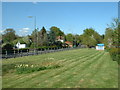
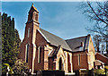
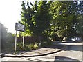

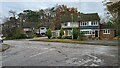
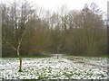
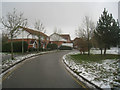
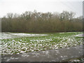
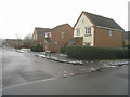
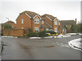
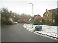
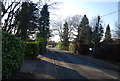
43 photos from this area
Area Information
Key information about the GU52 0YB including its size, population, and administrative classification.
- Area Type
- Postcode
- Area Size
- 2.5 hectares
- Population
- 1798
- Population Density
- 4668 people/km²
House Prices in GU52 0YB
66
Properties
£240,471
Average Sold Price
£58,500
Lowest Price
£475,000
Highest Price
Showing 66 properties
| Address | Type | Beds | Baths | Last Sale Price | Last Sale Date | |
|---|---|---|---|---|---|---|
| 29 Barn Meadow Close, Church Crookham, Fleet, GU52 0YB | Detached | 3 | 2 | £455,000 | Aug 2025 | |
| 19 Barn Meadow Close, Church Crookham, Fleet, GU52 0YB | Terraced | 2 | 1 | £375,000 | Aug 2025 | |
| 56 Barn Meadow Close, Church Crookham, Fleet, GU52 0YB | Terraced | 1 | 1 | £192,500 | Jun 2025 | |
| 54 Barn Meadow Close, Church Crookham, Fleet, GU52 0YB | Terraced | 1 | 1 | £197,000 | May 2025 | |
| 45 Barn Meadow Close, Church Crookham, Fleet, GU52 0YB | Terraced | 2 | 1 | £325,000 | Mar 2025 | |
| 60 Barn Meadow Close, Church Crookham, Fleet, GU52 0YB | house | - | - | £210,000 | Dec 2024 | |
| 9 Barn Meadow Close, Church Crookham, Fleet, GU52 0YB | house | 3 | 1 | £440,000 | Nov 2024 | |
| 1 Barn Meadow Close, Church Crookham, Fleet, GU52 0YB | Terraced | 2 | 2 | £385,000 | Apr 2024 | |
| 14 Barn Meadow Close, Church Crookham, Fleet, GU52 0YB | Terraced | 2 | 1 | £321,000 | Dec 2023 | |
| 67 Barn Meadow Close, Church Crookham, Fleet, GU52 0YB | Terraced | 3 | 2 | £437,000 | Oct 2023 |
Page 1 of 7
Energy Efficiency in GU52 0YB
Amenities
Schools
| Rank | School | Type | Entry gender | Ages |
|---|
Explore more schools in this area
Go to Schools tabDemographics
Household Size
Family (3-5 people)
most common
Accommodation Type
Houses
most common
Tenure
72
majority
Ethnic Group
White
most common
Religion
N/A
most common
Household Composition
N/A
most common
Age
47
median
Adults (30-64 years)
most common
Household Deprivation
N/A
with no deprivation
NS-SEC
50
in Lower managerial occupations
Explore more demographic insights in this area
Go to Demographics tabPlanning
Planning Constraints
- Flood RiskPremium
- Ramsar Wetland SitesPremium
- Area of Outstanding Natural BeautyPremium
- Protected Nature ReservePremium
- Protected WoodlandPremium