Area Overview for GU51 4NU
Photos of GU51 4NU
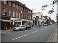

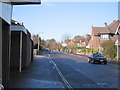
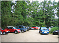
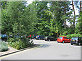
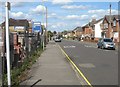
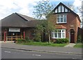
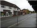
100 photos from this area
Area Information
Key information about the GU51 4NU including its size, population, and administrative classification.
- Area Type
- Postcode
- Area Size
- 6674 m²
- Population
- 2010
- Population Density
- 2799 people/km²
House Prices in GU51 4NU
28
Properties
£178,509
Average Sold Price
£52,650
Lowest Price
£256,000
Highest Price
Showing 28 properties
| Address | Type | Beds | Baths | Last Sale Price | Last Sale Date | |
|---|---|---|---|---|---|---|
| 46 Woodlands, Fleet, GU51 4NU | Maisonette | - | - | £230,000 | Sep 2023 | |
| 54 Woodlands, Fleet, GU51 4NU | Flat | 2 | 1 | £252,000 | Jun 2022 | |
| 47 Woodlands, Fleet, GU51 4NU | Flat | 1 | 1 | £160,000 | Dec 2021 | |
| 70 Woodlands, Fleet, GU51 4NU | Maisonette | 2 | - | £195,000 | Jun 2019 | |
| 80 Woodlands, Fleet, GU51 4NU | Flat | 1 | - | £183,500 | May 2018 | |
| 56 Woodlands, Fleet, GU51 4NU | Flat | - | - | £175,000 | Dec 2017 | |
| 76 Woodlands, Fleet, GU51 4NU | Flat | 3 | 1 | £237,000 | Sep 2017 | |
| 72 Woodlands, Fleet, GU51 4NU | Maisonette | - | - | £256,000 | Feb 2017 | |
| 74 Woodlands, Fleet, GU51 4NU | Flat | 2 | 1 | £182,500 | Aug 2015 | |
| 52 Woodlands, Fleet, GU51 4NU | Maisonette | - | - | £217,500 | Dec 2014 |
Page 1 of 3
Energy Efficiency in GU51 4NU
Amenities
Schools
| Rank | School | Type | Entry gender | Ages |
|---|
Explore more schools in this area
Go to Schools tabDemographics
Household Size
One person
most common
Accommodation Type
Houses
most common
Tenure
79
majority
Ethnic Group
White
most common
Religion
N/A
most common
Household Composition
N/A
most common
Age
47
median
Adults (30-64 years)
most common
Household Deprivation
N/A
with no deprivation
NS-SEC
49
in Lower managerial occupations
Explore more demographic insights in this area
Go to Demographics tabPlanning
Planning Constraints
- Flood RiskPremium
- Ramsar Wetland SitesPremium
- Area of Outstanding Natural BeautyPremium
- Protected Nature ReservePremium
- Protected WoodlandPremium