Area Overview for GU13 8NX
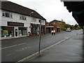
Photos of GU13 8NX


Area Information
GU13 8NX is a small residential postcode area in England, home to around 2,010 people. It is a compact cluster of properties, predominantly houses, reflecting a community that values stability and permanence. The area’s median age of 47 suggests a mature demographic, with most residents falling within the 30-64 age range. This makes it a place where families and long-term residents are likely to be found, contributing to a sense of continuity. Living here means access to essential services within practical reach, including retail outlets, rail links, and nearby airports. The area’s proximity to Fleet Railway Station and surrounding stations offers convenient connections to nearby towns, while the broadband score of 88 ensures reliable internet for both work and leisure. With a low crime risk score of 68 and no significant environmental constraints, GU13 8NX balances practicality with safety, making it a viable choice for those seeking a settled lifestyle in a low-maintenance setting.
- Area Type
- Postcode
- Area Size
- Not available
- Population
- 2010
- Population Density
- 2799 people/km²
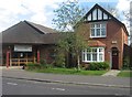
GU13 8NX is primarily an owner-occupied area, with 79% of residents living in properties they own. The accommodation type is predominantly houses, which is typical for smaller, rural or semi-rural postcode areas. This suggests a housing stock that caters to families or individuals seeking more space and privacy than smaller dwellings. The high home ownership rate indicates a stable market, with fewer rental properties available. For buyers, this means a focus on purchasing rather than renting, which could influence property values and demand. The presence of houses also implies that the area may have limited availability of newer developments or apartments, making it a niche market for those prioritising traditional housing. Proximity to rail links and nearby airports may also appeal to commuters or those requiring transport flexibility.
House Prices in GU13 8NX
No properties found in this postcode.
Energy Efficiency in GU13 8NX
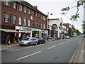
The lifestyle in GU13 8NX is shaped by its proximity to essential amenities. Retail options include Sainsburys Fleet, Morrisons Daily Fleet 229, and Co-op Fleet, providing access to grocery and daily necessities. The area’s rail stations—Fleet, Winchfield, and Farnborough—offer connections to broader transport networks, while nearby airports cater to those needing air travel. Though the data does not mention parks or leisure facilities directly, the absence of environmental constraints like protected woodlands or AONBs suggests open spaces may be available in surrounding areas. The combination of retail, transport, and proximity to airports creates a convenient environment for daily life, balancing local convenience with regional accessibility.
Amenities
Schools
The nearest school to GU13 8NX is Stockton House School, an independent institution. While no Ofsted rating is provided, the presence of an independent school suggests a focus on private education options for families in the area. This contrasts with the absence of state schools in the data, though it is possible that nearby towns host additional educational institutions. The availability of an independent school may appeal to parents seeking alternative educational pathways, though it is important to note that no further details about its curriculum, size, or performance are included. Families considering GU13 8NX should investigate additional schools in adjacent areas for a comprehensive view of educational opportunities.
| Rank | School | Type | Entry gender | Ages |
|---|
Explore more schools in this area
Go to Schools tabDemographics
The population of GU13 8NX is 2,010, with a median age of 47. The majority of residents fall within the 30-64 age range, indicating a community skewed towards middle-aged adults. Home ownership is high, at 79%, suggesting a strong presence of long-term residents. The area is predominantly composed of houses, reflecting a preference for traditional, larger properties over flats or apartments. The predominant ethnic group is White, which aligns with broader demographic trends in the region. While no specific data on deprivation is provided, the high home ownership rate and low crime risk imply a relatively stable economic environment. This demographic profile suggests a neighbourhood where families and professionals may find a balance between community cohesion and individual privacy.
Household Size
Accommodation Type
Tenure
Ethnic Group
Religion
Household Composition
Age
Household Deprivation
NS-SEC
Explore more demographic insights in this area
Go to Demographics tabPlanning
Planning Constraints
- Flood RiskPremium
- Ramsar Wetland SitesPremium
- Area of Outstanding Natural BeautyPremium
- Protected Nature ReservePremium
- Protected WoodlandPremium