Area Overview for GU51 3DT
Photos of GU51 3DT
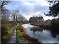
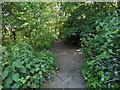
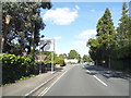
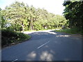

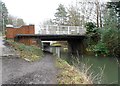

55 photos from this area
Area Information
Key information about the GU51 3DT including its size, population, and administrative classification.
- Area Type
- Postcode
- Area Size
- 8947 m²
- Population
- 1531
- Population Density
- 3144 people/km²
House Prices in GU51 3DT
10
Properties
£343,333
Average Sold Price
£106,000
Lowest Price
£462,000
Highest Price
Showing 10 properties
| Address | Type | Beds | Baths | Last Sale Price | Last Sale Date | |
|---|---|---|---|---|---|---|
| 156 Kings Road, Fleet, GU51 3DT | Semi-detached | 3 | 1 | £415,000 | Jun 2024 | |
| 150 Kings Road, Fleet, GU51 3DT | Semi-detached | 3 | 1 | £450,000 | Nov 2020 | |
| 152 Kings Road, Fleet, GU51 3DT | Semi-detached | 3 | - | £462,000 | Jun 2017 | |
| 140 Kings Road, Fleet, GU51 3DT | Detached | - | - | £400,000 | Jul 2007 | |
| 148 Kings Road, Fleet, GU51 3DT | Semi-detached | 3 | 2 | £227,000 | Oct 2002 | |
| 154 Kings Road, Fleet, GU51 3DT | house | - | - | £106,000 | May 1997 | |
| 160 Kings Road, Fleet, GU51 3DT | Retail | - | - | - | - | |
| 144 Kings Road, Fleet, GU51 3DT | Detached | - | - | - | - | |
| 146 Kings Road, Fleet, GU51 3DT | Semi-detached | - | - | - | - | |
| 142 Kings Road, Fleet, GU51 3DT | Semi-detached | - | - | - | - |
Energy Efficiency in GU51 3DT
Amenities
Schools
| Rank | School | Type | Entry gender | Ages |
|---|
Explore more schools in this area
Go to Schools tabDemographics
Household Size
Two person
most common
Accommodation Type
Houses
most common
Tenure
83
majority
Ethnic Group
White
most common
Religion
N/A
most common
Household Composition
N/A
most common
Age
47
median
Adults (30-64 years)
most common
Household Deprivation
N/A
with no deprivation
NS-SEC
45
in Lower managerial occupations
Explore more demographic insights in this area
Go to Demographics tabPlanning
Planning Constraints
- Flood RiskPremium
- Ramsar Wetland SitesPremium
- Area of Outstanding Natural BeautyPremium
- Protected Nature ReservePremium
- Protected WoodlandPremium