Area Overview for GU51 3DR
Photos of GU51 3DR


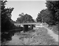

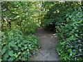
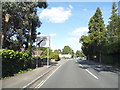
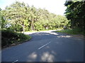

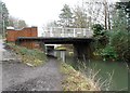
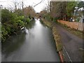
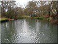

55 photos from this area
Area Information
Key information about the GU51 3DR including its size, population, and administrative classification.
- Area Type
- Postcode
- Area Size
- 7770 m²
- Population
- 1676
- Population Density
- 2480 people/km²
House Prices in GU51 3DR
13
Properties
£531,286
Average Sold Price
£120,000
Lowest Price
£850,000
Highest Price
Showing 13 properties
| Address | Type | Beds | Baths | Last Sale Price | Last Sale Date | |
|---|---|---|---|---|---|---|
| 135 Kings Road, Fleet, GU51 3DR | Detached | 4 | 2 | £624,000 | Feb 2025 | |
| 119 Kings Road, Fleet, GU51 3DR | Detached | 4 | 1 | £515,000 | May 2021 | |
| 121A Kings Road, Fleet, GU51 3DR | Detached | 4 | 2 | £560,000 | Feb 2018 | |
| 131 Kings Road, Fleet, GU51 3DR | Detached | 5 | - | £850,000 | Oct 2017 | |
| 137 Kings Road, Fleet, GU51 3DR | Bungalow | 2 | - | £415,000 | Mar 2016 | |
| 125 Kings Road, Fleet, GU51 3DR | Detached | 5 | 2 | £635,000 | Mar 2012 | |
| 127 Kings Road, Fleet, GU51 3DR | Detached | - | - | £120,000 | Feb 1995 | |
| 121 Kings Road, Fleet, GU51 3DR | Detached | 4 | 3 | - | - | |
| 123 Kings Road, Fleet, GU51 3DR | house | - | - | - | - | |
| 117 Kings Road, Fleet, GU51 3DR | Semi-detached | - | - | - | - |
Page 1 of 2
Energy Efficiency in GU51 3DR
Amenities
Schools
| Rank | School | Type | Entry gender | Ages |
|---|
Explore more schools in this area
Go to Schools tabDemographics
Household Size
Two person
most common
Accommodation Type
Houses
most common
Tenure
91
majority
Ethnic Group
White
most common
Religion
N/A
most common
Household Composition
N/A
most common
Age
47
median
Adults (30-64 years)
most common
Household Deprivation
N/A
with no deprivation
NS-SEC
56
in Lower managerial occupations
Explore more demographic insights in this area
Go to Demographics tabPlanning
Planning Constraints
- Flood RiskPremium
- Ramsar Wetland SitesPremium
- Area of Outstanding Natural BeautyPremium
- Protected Nature ReservePremium
- Protected WoodlandPremium