Area Overview for GU47 0SG
Photos of GU47 0SG
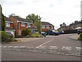
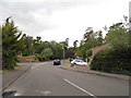
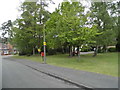
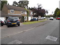
46 photos from this area
Area Information
Key information about the GU47 0SG including its size, population, and administrative classification.
- Area Type
- Postcode
- Area Size
- 9331 m²
- Population
- 1143
- Population Density
- 6277 people/km²
House Prices in GU47 0SG
24
Properties
£288,622
Average Sold Price
£98,000
Lowest Price
£550,000
Highest Price
Showing 24 properties
| Address | Type | Beds | Baths | Last Sale Price | Last Sale Date | |
|---|---|---|---|---|---|---|
| 16 Oak Avenue, Owlsmoor, Sandhurst, GU47 0SG | house | 4 | 2 | £550,000 | Oct 2025 | |
| 36 Oak Avenue, Owlsmoor, Sandhurst, GU47 0SG | Semi-detached | 3 | 1 | £385,000 | Sep 2024 | |
| 48 Oak Avenue, Owlsmoor, Sandhurst, GU47 0SG | Semi-detached | 4 | 2 | £450,000 | Nov 2023 | |
| 12 Oak Avenue, Owlsmoor, Sandhurst, GU47 0SG | Semi-detached | 5 | - | £485,000 | Aug 2022 | |
| 6 Oak Avenue, Owlsmoor, Sandhurst, GU47 0SG | Semi-detached | 3 | - | £355,000 | Mar 2021 | |
| 44 Oak Avenue, Owlsmoor, Sandhurst, GU47 0SG | Semi-detached | 3 | - | £321,000 | Oct 2015 | |
| 8 Oak Avenue, Owlsmoor, Sandhurst, GU47 0SG | house | 2 | 2 | £295,000 | Nov 2013 | |
| 28 Oak Avenue, Owlsmoor, Sandhurst, GU47 0SG | house | 3 | - | £250,000 | Aug 2013 | |
| 24 Oak Avenue, Owlsmoor, Sandhurst, GU47 0SG | Semi-detached | 3 | - | £235,000 | Jun 2013 | |
| 20 Oak Avenue, Owlsmoor, Sandhurst, GU47 0SG | house | 3 | - | £232,000 | Mar 2013 |
Page 1 of 3
Energy Efficiency in GU47 0SG
Amenities
Schools
| Rank | School | Type | Entry gender | Ages |
|---|
Explore more schools in this area
Go to Schools tabDemographics
Household Size
Family (3-5 people)
most common
Accommodation Type
Houses
most common
Tenure
86
majority
Ethnic Group
White
most common
Religion
N/A
most common
Household Composition
N/A
most common
Age
47
median
Adults (30-64 years)
most common
Household Deprivation
N/A
with no deprivation
NS-SEC
41
in Lower managerial occupations
Explore more demographic insights in this area
Go to Demographics tabPlanning
Planning Constraints
- Flood RiskPremium
- Ramsar Wetland SitesPremium
- Area of Outstanding Natural BeautyPremium
- Protected Nature ReservePremium
- Protected WoodlandPremium