Area Overview for GU47 0SD
Photos of GU47 0SD
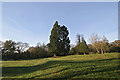
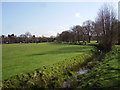
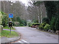

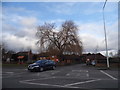
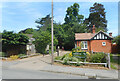
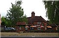
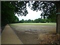
79 photos from this area
Area Information
Key information about the GU47 0SD including its size, population, and administrative classification.
- Area Type
- Postcode
- Area Size
- 4.6 hectares
- Population
- 1417
- Population Density
- 3642 people/km²
House Prices in GU47 0SD
18
Properties
£377,638
Average Sold Price
£135,000
Lowest Price
£523,500
Highest Price
Showing 18 properties
| Address | Type | Beds | Baths | Last Sale Price | Last Sale Date | |
|---|---|---|---|---|---|---|
| Kastanon, 11 Owlsmoor Road, Owlsmoor, Sandhurst, GU47 0SD | Bungalow | 4 | 2 | £523,500 | Apr 2025 | |
| Mayborne, 9 Owlsmoor Road, Owlsmoor, Sandhurst, GU47 0SD | Bungalow | 3 | 1 | £405,000 | Nov 2023 | |
| Pippins, 15 Owlsmoor Road, Owlsmoor, Sandhurst, GU47 0SD | Semi-detached | 3 | 1 | £427,800 | Nov 2021 | |
| 23 Owlsmoor Road, Owlsmoor, Sandhurst, GU47 0SD | Detached | 4 | 4 | £437,525 | Sep 2014 | |
| 29 Owlsmoor Road, Owlsmoor, Sandhurst, GU47 0SD | house | - | - | £337,000 | Aug 2012 | |
| Hazeldene, 25 Owlsmoor Road, Owlsmoor, Sandhurst, GU47 0SD | Semi-detached | - | - | £135,000 | Jun 2000 | |
| Woodleigh, 7 Owlsmoor Road, Owlsmoor, Sandhurst, GU47 0SD | Detached | 4 | 4 | - | - | |
| Holly House, 1 Owlsmoor Road, Owlsmoor, Sandhurst, GU47 0SD | house | 4 | - | - | - | |
| The Spot, Sandhurst Youth Centre, Owlsmoor Road, Owlsmoor, Sandhurst, GU47 0SD | commercial | - | - | - | - | |
| Linden, 27 Owlsmoor Road, Owlsmoor, Sandhurst, GU47 0SD | Semi-detached | - | - | - | - |
Page 1 of 2
Energy Efficiency in GU47 0SD
Amenities
Schools
| Rank | School | Type | Entry gender | Ages |
|---|
Explore more schools in this area
Go to Schools tabDemographics
Household Size
Family (3-5 people)
most common
Accommodation Type
Houses
most common
Tenure
73
majority
Ethnic Group
White
most common
Religion
N/A
most common
Household Composition
N/A
most common
Age
47
median
Adults (30-64 years)
most common
Household Deprivation
N/A
with no deprivation
NS-SEC
32
in Lower managerial occupations
Explore more demographic insights in this area
Go to Demographics tabPlanning
Planning Constraints
- Flood RiskPremium
- Ramsar Wetland SitesPremium
- Area of Outstanding Natural BeautyPremium
- Protected Nature ReservePremium
- Protected WoodlandPremium