Area Overview for GU46 6AQ
Photos of GU46 6AQ
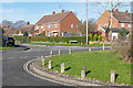
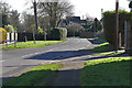
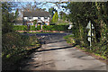
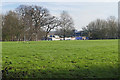
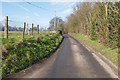
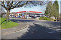
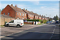
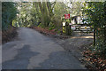
32 photos from this area
Area Information
Key information about the GU46 6AQ including its size, population, and administrative classification.
- Area Type
- Postcode
- Area Size
- 1.4 hectares
- Population
- 1851
- Population Density
- 897 people/km²
House Prices in GU46 6AQ
14
Properties
£335,422
Average Sold Price
£129,950
Lowest Price
£675,000
Highest Price
Showing 14 properties
| Address | Type | Beds | Baths | Last Sale Price | Last Sale Date | |
|---|---|---|---|---|---|---|
| 7 Round Close, Yateley, GU46 6AQ | house | - | - | £675,000 | Mar 2016 | |
| 3 Round Close, Yateley, GU46 6AQ | house | - | - | £384,950 | Oct 2013 | |
| Lilac Cottage, 2 Round Close, Yateley, GU46 6AQ | house | - | - | £366,000 | Nov 2009 | |
| 11 Round Close, Yateley, GU46 6AQ | Bungalow | - | - | £249,995 | Aug 2006 | |
| 25 Round Close, Yateley, GU46 6AQ | Bungalow | 2 | - | £225,950 | Aug 2004 | |
| Poppy Cottage, 17 Round Close, Yateley, GU46 6AQ | Detached | - | - | £379,950 | Jul 2004 | |
| Gladhaven, 23 Round Close, Yateley, GU46 6AQ | Detached | - | - | £167,000 | Aug 2001 | |
| 1 Round Close, Yateley, GU46 6AQ | Detached | - | - | £440,000 | May 2000 | |
| 5 Round Close, Yateley, GU46 6AQ | Detached | 4 | 2 | £129,950 | Sep 1995 | |
| 27 Round Close, Yateley, GU46 6AQ | Detached | - | - | - | - |
Page 1 of 2
Energy Efficiency in GU46 6AQ
Amenities
Schools
| Rank | School | Type | Entry gender | Ages |
|---|
Explore more schools in this area
Go to Schools tabDemographics
Household Size
Family (3-5 people)
most common
Accommodation Type
Houses
most common
Tenure
85
majority
Ethnic Group
White
most common
Religion
N/A
most common
Household Composition
N/A
most common
Age
47
median
Adults (30-64 years)
most common
Household Deprivation
N/A
with no deprivation
NS-SEC
45
in Lower managerial occupations
Explore more demographic insights in this area
Go to Demographics tabPlanning
Planning Constraints
- Flood RiskPremium
- Ramsar Wetland SitesPremium
- Area of Outstanding Natural BeautyPremium
- Protected Nature ReservePremium
- Protected WoodlandPremium