Area Overview for GU4 8RB
Photos of GU4 8RB
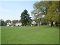
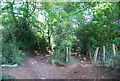
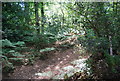
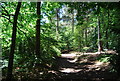
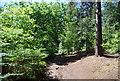
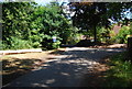
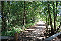
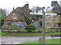
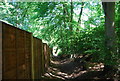
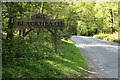
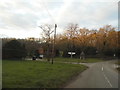
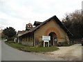
105 photos from this area
Area Information
Key information about the GU4 8RB including its size, population, and administrative classification.
- Area Type
- Postcode
- Area Size
- 38.1 hectares
- Population
- 1872
- Population Density
- 286 people/km²
House Prices in GU4 8RB
28
Properties
£1,164,312
Average Sold Price
£363,250
Lowest Price
£4,200,000
Highest Price
Showing 28 properties
| Address | Type | Beds | Baths | Last Sale Price | Last Sale Date | |
|---|---|---|---|---|---|---|
| Sandilands, Blackheath Lane, Blackheath, Guildford, GU4 8RB | Semi-detached | 4 | 3 | £1,290,000 | May 2024 | |
| St Anthonys, Blackheath Lane, Blackheath, Guildford, GU4 8RB | house | - | - | £895,000 | Jan 2023 | |
| Prince Albert Cottage, Blackheath Lane, Blackheath, Guildford, GU4 8RB | Detached | 3 | 2 | £900,000 | Nov 2020 | |
| Bramfell, Blackheath Lane, Blackheath, Guildford, GU4 8RB | Detached | 4 | - | £1,185,000 | Dec 2018 | |
| Rosemary Hill, Blackheath Lane, Blackheath, Guildford, GU4 8RB | house | 6 | - | £4,200,000 | May 2014 | |
| Heath House, Blackheath Lane, Blackheath, Guildford, GU4 8RB | house | - | - | £1,650,000 | Sep 2010 | |
| Holly Hedge, Blackheath Lane, Blackheath, Guildford, GU4 8RB | house | - | - | £755,000 | Sep 2010 | |
| Tarsia Cottage, Blackheath Lane, Blackheath, Guildford, GU4 8RB | house | - | - | £363,250 | Apr 2006 | |
| Camerton Cottage, Blackheath Lane, Blackheath, Guildford, GU4 8RB | Land | - | - | £760,000 | Jul 2004 | |
| Winter Meadow, Blackheath Lane, Blackheath, Guildford, GU4 8RB | Detached | - | - | £1,100,000 | Jun 2001 |
Page 1 of 3
Energy Efficiency in GU4 8RB
Amenities
Schools
| Rank | School | Type | Entry gender | Ages |
|---|
Explore more schools in this area
Go to Schools tabDemographics
Household Size
Family (3-5 people)
most common
Accommodation Type
Houses
most common
Tenure
84
majority
Ethnic Group
White
most common
Religion
N/A
most common
Household Composition
N/A
most common
Age
47
median
Adults (30-64 years)
most common
Household Deprivation
N/A
with no deprivation
NS-SEC
51
in Lower managerial occupations
Explore more demographic insights in this area
Go to Demographics tabPlanning
Planning Constraints
- Flood RiskPremium
- Ramsar Wetland SitesPremium
- Area of Outstanding Natural BeautyPremium
- Protected Nature ReservePremium
- Protected WoodlandPremium