Area Overview for GU4 8LU
Photos of GU4 8LU
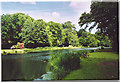
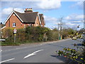
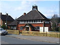
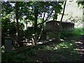
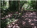
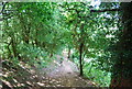
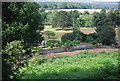
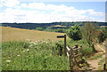
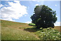
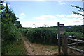
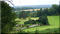
100 photos from this area
Area Information
Key information about the GU4 8LU including its size, population, and administrative classification.
- Area Type
- Postcode
- Area Size
- 1.0 hectares
- Population
- 1857
- Population Density
- 1862 people/km²
House Prices in GU4 8LU
34
Properties
£348,850
Average Sold Price
£130,000
Lowest Price
£700,000
Highest Price
Showing 34 properties
| Address | Type | Beds | Baths | Last Sale Price | Last Sale Date | |
|---|---|---|---|---|---|---|
| 90 New Road, Chilworth, GU4 8LU | Semi-detached | 3 | 2 | £485,000 | Jul 2025 | |
| 78 New Road, Chilworth, GU4 8LU | Terraced | 3 | 2 | £520,000 | Mar 2025 | |
| 108 New Road, Chilworth, GU4 8LU | house | - | - | £510,000 | May 2024 | |
| 88 New Road, Chilworth, GU4 8LU | Detached | 4 | 2 | £653,000 | Mar 2024 | |
| 86 New Road, Chilworth, GU4 8LU | Maisonette | - | - | £260,000 | Aug 2021 | |
| 68 New Road, Chilworth, GU4 8LU | Semi-detached | 2 | 1 | £450,000 | Jun 2021 | |
| 118 New Road, Chilworth, GU4 8LU | Semi-detached | 4 | 1 | £490,000 | Sep 2020 | |
| 94 New Road, Chilworth, GU4 8LU | Semi-detached | 3 | 1 | £336,000 | Jul 2020 | |
| 96 New Road, Chilworth, GU4 8LU | Semi-detached | 2 | 1 | £335,500 | Jun 2020 | |
| 104 New Road, Chilworth, GU4 8LU | Semi-detached | 3 | 2 | £201,750 | Sep 2019 |
Page 1 of 4
Energy Efficiency in GU4 8LU
Amenities
Schools
| Rank | School | Type | Entry gender | Ages |
|---|
Explore more schools in this area
Go to Schools tabDemographics
Household Size
Family (3-5 people)
most common
Accommodation Type
Houses
most common
Tenure
66
majority
Ethnic Group
White
most common
Religion
N/A
most common
Household Composition
N/A
most common
Age
47
median
Adults (30-64 years)
most common
Household Deprivation
N/A
with no deprivation
NS-SEC
44
in Lower managerial occupations
Explore more demographic insights in this area
Go to Demographics tabPlanning
Planning Constraints
- Flood RiskPremium
- Ramsar Wetland SitesPremium
- Area of Outstanding Natural BeautyPremium
- Protected Nature ReservePremium
- Protected WoodlandPremium