Area Overview for GU34 5SU
Photos of GU34 5SU
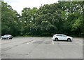
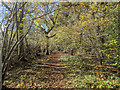
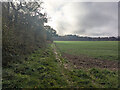
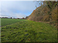

25 photos from this area
Area Information
Key information about the GU34 5SU including its size, population, and administrative classification.
- Area Type
- Postcode
- Area Size
- 1.0 km²
- Population
- 1394
- Population Density
- 40 people/km²
House Prices in GU34 5SU
4
Properties
£637,500
Average Sold Price
£575,000
Lowest Price
£700,000
Highest Price
Showing 4 properties
| Address | Type | Beds | Baths | Last Sale Price | Last Sale Date | |
|---|---|---|---|---|---|---|
| Cedar Lodge, The Avenue, Lasham, GU34 5SU | Bungalow | 3 | 2 | £700,000 | Jun 2020 | |
| Stable Lodge, The Avenue, Lasham, GU34 5SU | Bungalow | 1 | 1 | £575,000 | Aug 2006 | |
| Recycling Site, Avenue Nurseries Garden Centre, The Avenue, Lasham, GU34 5SU | commercial | - | - | - | - | |
| Warehouses To The North East Of, Avenue Road, Lasham, Alton, GU34 5SU | warehouse | - | - | - | - |
Energy Efficiency in GU34 5SU
Amenities
Schools
| Rank | School | Type | Entry gender | Ages |
|---|
Explore more schools in this area
Go to Schools tabDemographics
Household Size
Two person
most common
Accommodation Type
Houses
most common
Tenure
76
majority
Ethnic Group
White
most common
Religion
N/A
most common
Household Composition
N/A
most common
Age
47
median
Adults (30-64 years)
most common
Household Deprivation
N/A
with no deprivation
NS-SEC
51
in Lower managerial occupations
Explore more demographic insights in this area
Go to Demographics tabPlanning
Planning Constraints
- Flood RiskPremium
- Ramsar Wetland SitesPremium
- Area of Outstanding Natural BeautyPremium
- Protected Nature ReservePremium
- Protected WoodlandPremium