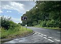
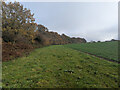
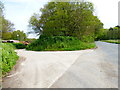
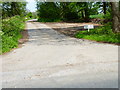
Area Overview for GU34 5SS
Photos of GU34 5SS


Area Information
Living in GU34 5SS means inhabiting a small, tightly knit residential cluster in England. The area spans 26.5 hectares and is home to 1,394 residents, translating to a low population density of 40 people per square kilometre. This quiet setting suggests a community where space is not a constraint, and the pace of life is likely measured. The area’s demographic profile indicates a mature population, with a median age of 47 and the majority of residents falling within the 30–64 age bracket. This suggests a stable, established community, with many residents likely to be homeowners. The absence of major environmental constraints, such as protected woodlands or AONB coverage, means development is not restricted by planning hurdles. For those seeking a peaceful, low-risk environment, GU34 5SS offers a safe, low-crime setting with minimal flood risk. Its proximity to two airports, a railway station, and local retail hubs positions it as a practical location for those balancing convenience with a quieter lifestyle.
- Area Type
- Postcode
- Area Size
- 26.5 hectares
- Population
- 1394
- Population Density
- 40 people/km²
The property market in GU34 5SS is characterised by a high rate of home ownership, with 76% of residents owning their homes. The area is primarily composed of houses, indicating a lack of high-density housing such as flats or apartments. This suggests a market that caters to owner-occupiers rather than renters, with limited availability of rental properties. The small size of the area—just 26.5 hectares—means the housing stock is likely to be modest in scale, with a focus on individual homes rather than large developments. Buyers should consider the area’s limited size when evaluating property options, as the immediate surroundings may offer few additional choices. The predominance of houses also implies that properties are likely to be family-friendly, with larger living spaces. However, the lack of specific data on property prices or recent sales means potential buyers should conduct local inquiries to gauge current market conditions.
House Prices in GU34 5SS
Showing 1 properties
| Address | Type | Beds | Baths | Last Sale Price | Last Sale Date | |
|---|---|---|---|---|---|---|
| Caravan F, Lasham Gliding Society Ltd, Avenue Road, Lasham, Alton, GU34 5SS | office_workshop | - | - | - | - |
Energy Efficiency in GU34 5SS
Residents of GU34 5SS have access to a range of nearby amenities within practical reach. Local retail options include Tesco Alton, The Southern Co-operative Co, and Waitrose Alton, providing essential shopping and grocery needs. The area’s proximity to Alton Railway Station and Medstead & Four Marks metro station enhances mobility for those reliant on public transport. While the data does not specify dining or leisure venues, the presence of major retail chains suggests a functional retail environment. The small size of the area means amenities are likely to be concentrated, offering convenience for daily errands. The absence of major parks or leisure facilities is not mentioned, but the low population density implies space for informal outdoor activities. Overall, the area balances practicality with a quiet, low-stimulus lifestyle, ideal for those prioritising accessibility over urban vibrancy.
Amenities
Schools
| Rank | School | Type | Entry gender | Ages |
|---|
Explore more schools in this area
Go to Schools tabDemographics
The community in GU34 5SS is predominantly composed of adults aged 30–64, with a median age of 47. This suggests a mature population, likely with long-term ties to the area. Home ownership is high, with 76% of residents owning their homes, and the primary accommodation type is houses rather than flats or apartments. The predominant ethnic group is White, and no specific data on diversity or deprivation is provided, though the low population density and stable age profile imply a relatively homogeneous community. With 1,394 people spread across 26.5 hectares, the area is sparsely populated, offering a sense of space and privacy. The absence of significant deprivation indicators, combined with a low crime risk, points to a quality of life that prioritises safety and stability. This demographic profile suggests a community where families and long-term residents are likely to be the majority.
Household Size
Accommodation Type
Tenure
Ethnic Group
Religion
Household Composition
Age
Household Deprivation
NS-SEC
Explore more demographic insights in this area
Go to Demographics tabPlanning
Planning Constraints
- Flood RiskPremium
- Ramsar Wetland SitesPremium
- Area of Outstanding Natural BeautyPremium
- Protected Nature ReservePremium
- Protected WoodlandPremium