Area Overview for GU34 4LS
Photos of GU34 4LS

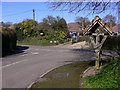
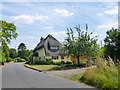
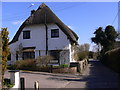


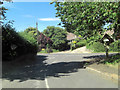


12 photos from this area
Area Information
Key information about the GU34 4LS including its size, population, and administrative classification.
- Area Type
- Postcode
- Area Size
- 5.2 hectares
- Population
- 1394
- Population Density
- 40 people/km²
House Prices in GU34 4LS
16
Properties
£480,800
Average Sold Price
£375,000
Lowest Price
£689,000
Highest Price
Showing 16 properties
| Address | Type | Beds | Baths | Last Sale Price | Last Sale Date | |
|---|---|---|---|---|---|---|
| Porch Cottage, Froyle Road, Lower Froyle, Alton, GU34 4LS | house | - | - | £525,000 | Oct 2018 | |
| Chandler's Yard, Froyle Road, Lower Froyle, Alton, GU34 4LS | Terraced | 3 | 1 | £375,000 | Jul 2018 | |
| Orchard Cottage, Froyle Road, Lower Froyle, Alton, GU34 4LS | house | 4 | 2 | £689,000 | Apr 2018 | |
| Greenfields Cottage, Froyle Road, Lower Froyle, Alton, GU34 4LS | Semi-detached | - | - | £420,000 | Apr 2008 | |
| Highfield, Froyle Road, Lower Froyle, Alton, GU34 4LS | Detached | - | - | £395,000 | Dec 2005 | |
| Golden Cottage, Froyle Road, Lower Froyle, Alton, GU34 4LS | Detached | 2 | 1 | - | - | |
| Mysts Of Tyme, Froyle Road, Lower Froyle, Alton, GU34 4LS | house | 4 | 2 | - | - | |
| Meadowview, Froyle Road, Lower Froyle, Alton, GU34 4LS | Detached | 3 | 2 | - | - | |
| Greendown, Froyle Road, Lower Froyle, Alton, GU34 4LS | Terraced | - | - | - | - | |
| International Property Show & Gallery, Froyle Road, Lower Froyle, Alton, GU34 4LS | Office | - | - | - | - |
Page 1 of 2
Energy Efficiency in GU34 4LS
Amenities
Schools
| Rank | School | Type | Entry gender | Ages |
|---|
Explore more schools in this area
Go to Schools tabDemographics
Household Size
Two person
most common
Accommodation Type
Houses
most common
Tenure
76
majority
Ethnic Group
White
most common
Religion
N/A
most common
Household Composition
N/A
most common
Age
47
median
Adults (30-64 years)
most common
Household Deprivation
N/A
with no deprivation
NS-SEC
51
in Lower managerial occupations
Explore more demographic insights in this area
Go to Demographics tabPlanning
Planning Constraints
- Flood RiskPremium
- Ramsar Wetland SitesPremium
- Area of Outstanding Natural BeautyPremium
- Protected Nature ReservePremium
- Protected WoodlandPremium