Area Overview for GU34 2EH
Photos of GU34 2EH
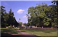
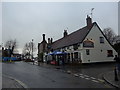
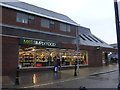
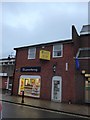
99 photos from this area
Area Information
Key information about the GU34 2EH including its size, population, and administrative classification.
- Area Type
- Postcode
- Area Size
- 8513 m²
- Population
- 1104
- Population Density
- 2264 people/km²
House Prices in GU34 2EH
21
Properties
£269,450
Average Sold Price
£70,000
Lowest Price
£373,000
Highest Price
Showing 21 properties
| Address | Type | Beds | Baths | Last Sale Price | Last Sale Date | |
|---|---|---|---|---|---|---|
| 12 Vyne Close, Alton, GU34 2EH | Semi-detached | 3 | 1 | £358,000 | Aug 2023 | |
| 1 Vyne Close, Alton, GU34 2EH | Semi-detached | 4 | 2 | £370,000 | Mar 2023 | |
| 7 Vyne Close, Alton, GU34 2EH | Semi-detached | 2 | 1 | £357,000 | Feb 2019 | |
| 3 Vyne Close, Alton, GU34 2EH | Bungalow | - | - | £373,000 | Jul 2017 | |
| 17 Vyne Close, Alton, GU34 2EH | Bungalow | - | - | £290,000 | Feb 2015 | |
| 9 Vyne Close, Alton, GU34 2EH | Bungalow | 2 | - | £267,500 | Jul 2011 | |
| 15 Vyne Close, Alton, GU34 2EH | Bungalow | 3 | - | £277,000 | Jun 2011 | |
| 22 Vyne Close, Alton, GU34 2EH | Semi-detached | 3 | - | £250,000 | Oct 2010 | |
| 11 Vyne Close, Alton, GU34 2EH | Semi-detached | - | - | £70,000 | Feb 1996 | |
| Keyes House, 4 Vyne Close, Alton, GU34 2EH | Semi-detached | - | - | £82,000 | Jun 1995 |
Page 1 of 3
Energy Efficiency in GU34 2EH
Amenities
Schools
| Rank | School | Type | Entry gender | Ages |
|---|
Explore more schools in this area
Go to Schools tabDemographics
Household Size
Two person
most common
Accommodation Type
Houses
most common
Tenure
82
majority
Ethnic Group
White
most common
Religion
N/A
most common
Household Composition
N/A
most common
Age
47
median
Adults (30-64 years)
most common
Household Deprivation
N/A
with no deprivation
NS-SEC
37
in Lower managerial occupations
Explore more demographic insights in this area
Go to Demographics tabPlanning
Planning Constraints
- Flood RiskPremium
- Ramsar Wetland SitesPremium
- Area of Outstanding Natural BeautyPremium
- Protected Nature ReservePremium
- Protected WoodlandPremium