Area Overview for GU31 5EQ
Photos of GU31 5EQ
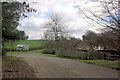
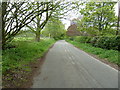
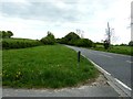
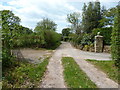

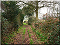
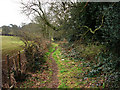
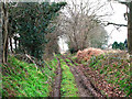
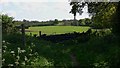

14 photos from this area
Area Information
Key information about the GU31 5EQ including its size, population, and administrative classification.
- Area Type
- Postcode
- Area Size
- 65.8 hectares
- Population
- 1338
- Population Density
- 66 people/km²
House Prices in GU31 5EQ
5
Properties
£1,225,000
Average Sold Price
£160,000
Lowest Price
£2,350,000
Highest Price
Showing 5 properties
| Address | Type | Beds | Baths | Last Sale Price | Last Sale Date | |
|---|---|---|---|---|---|---|
| Terwick Old Rectory, Old Rectory, Rogate, GU31 5EQ | Detached | - | - | £1,790,000 | Oct 2018 | |
| Mills Farm House, Mills Farm Road, Rogate, GU31 5EQ | Detached | - | - | £160,000 | Jul 2017 | |
| Green Mead, Old Rectory, Rogate, GU31 5EQ | Equestrian | 5 | 3 | £2,350,000 | Jul 2017 | |
| Frogs Hole, Old Rectory, Rogate, GU31 5EQ | Detached | - | - | £600,000 | Jan 2010 | |
| Tennis 54M From Terwick Old Rectory 50M From A272, A 272 Terwick Lane To Old Rectory, Rogate, GU31 5EQ | Leisure | - | - | - | - |
Energy Efficiency in GU31 5EQ
Amenities
Schools
| Rank | School | Type | Entry gender | Ages |
|---|
Explore more schools in this area
Go to Schools tabDemographics
Household Size
Two person
most common
Accommodation Type
Houses
most common
Tenure
70
majority
Ethnic Group
White
most common
Religion
N/A
most common
Household Composition
N/A
most common
Age
47
median
Adults (30-64 years)
most common
Household Deprivation
N/A
with no deprivation
NS-SEC
43
in Lower managerial occupations
Explore more demographic insights in this area
Go to Demographics tabPlanning
Planning Constraints
- Flood RiskPremium
- Ramsar Wetland SitesPremium
- Area of Outstanding Natural BeautyPremium
- Protected Nature ReservePremium
- Protected WoodlandPremium