Area Overview for GU31 5EF
Photos of GU31 5EF


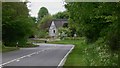
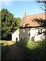
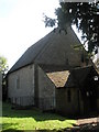
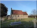

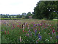
48 photos from this area
Area Information
Key information about the GU31 5EF including its size, population, and administrative classification.
- Area Type
- Postcode
- Area Size
- 28.3 hectares
- Population
- 1338
- Population Density
- 66 people/km²
House Prices in GU31 5EF
10
Properties
£790,151
Average Sold Price
£135,000
Lowest Price
£1,650,000
Highest Price
Showing 10 properties
| Address | Type | Beds | Baths | Last Sale Price | Last Sale Date | |
|---|---|---|---|---|---|---|
| Old Fyning House, A 272 From Fyning Lane To Terwick Lane, Rogate, GU31 5EF | Detached | 5 | 3 | £1,000,000 | Aug 2020 | |
| Old Bell Cottage, A 272 From Fyning Lane To Terwick Lane, Rogate, GU31 5EF | Semi-detached | 4 | 1 | £625,000 | Sep 2019 | |
| Fyning House, A 272 From Fyning Lane To Terwick Lane, Rogate, GU31 5EF | Detached | 6 | 4 | £1,650,000 | Jul 2016 | |
| Fyning Manor, Terwick Common Lane, Rogate, GU31 5EF | Detached | 4 | - | £1,593,000 | Aug 2012 | |
| Fyning Barn, A 272 From Fyning Lane To Terwick Lane, Rogate, GU31 5EF | Detached | 4 | 2 | £835,000 | Nov 2005 | |
| Knapp Hill, Terwick Common Lane, Rogate, GU31 5EF | Detached | - | - | £245,708 | Mar 2005 | |
| Fyning Knapp, Terwick Common Lane, Rogate, GU31 5EF | Detached | - | - | £237,500 | Jul 1998 | |
| Fyning Lodge, A 272 From Fyning Lane To Terwick Lane, Rogate, GU31 5EF | Detached | - | - | £135,000 | Oct 1995 | |
| Gardeners Cottage, A 272 From Fyning Lane To Terwick Lane, Rogate, GU31 5EF | Detached | - | - | - | - | |
| Old Stable Cottage, A 272 From Fyning Lane To Terwick Lane, Rogate, GU31 5EF | Detached | - | - | - | - |
Energy Efficiency in GU31 5EF
Amenities
Schools
| Rank | School | Type | Entry gender | Ages |
|---|
Explore more schools in this area
Go to Schools tabDemographics
Household Size
Two person
most common
Accommodation Type
Houses
most common
Tenure
70
majority
Ethnic Group
White
most common
Religion
N/A
most common
Household Composition
N/A
most common
Age
47
median
Adults (30-64 years)
most common
Household Deprivation
N/A
with no deprivation
NS-SEC
43
in Lower managerial occupations
Explore more demographic insights in this area
Go to Demographics tabPlanning
Planning Constraints
- Flood RiskPremium
- Ramsar Wetland SitesPremium
- Area of Outstanding Natural BeautyPremium
- Protected Nature ReservePremium
- Protected WoodlandPremium