Area Overview for GU29 9JJ
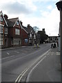
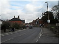
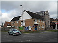
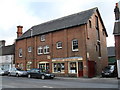
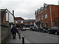
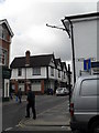
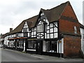
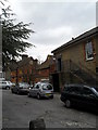
Photos of GU29 9JJ


Area Information
GU29 9JJ is a small, tightly knit residential postcode in England, covering 3,133 square metres and home to 1,905 residents. Its compact size means it’s a quiet, community-focused area where daily life revolves around local amenities and nearby schools. The population density of 979 people per square kilometre suggests a mix of established homes and a stable, mature demographic. With a median age of 47 and a majority of residents aged 30–64, this area caters to families and professionals seeking a settled environment. The presence of several schools, including a primary school and an outstanding academy, indicates a focus on education. While the area lacks major transport hubs, its proximity to retail outlets like Sainsburys and Tesco ensures everyday convenience. The low crime risk and absence of environmental constraints make it an appealing choice for those prioritising safety and simplicity. For buyers, GU29 9JJ offers a rare blend of residential tranquillity and practical accessibility, ideal for those seeking a balanced lifestyle away from urban centres.
- Area Type
- Postcode
- Area Size
- 3133 m²
- Population
- 1905
- Population Density
- 979 people/km²
The property market in GU29 9JJ is characterised by a high proportion of owner-occupied homes, with 61% of properties owned by residents. This suggests a stable market with limited turnover, typical of a mature community. The accommodation type is primarily houses, which are well-suited to families and those seeking space. Given the area’s small size, the housing stock is limited, making it a niche market for buyers prioritising proximity to schools and amenities. The focus on owner-occupation indicates a lack of significant rental demand, though this may change with shifting demographics. For buyers, the challenge lies in the area’s compact nature, which means properties are likely to be in close proximity to one another. The market is best suited for those seeking a quiet, established home rather than investment opportunities.
House Prices in GU29 9JJ
Showing 16 properties
| Address | Type | Beds | Baths | Last Sale Price | Last Sale Date | |
|---|---|---|---|---|---|---|
| 11, The Rockeries, Petersfield Road, Midhurst, GU29 9JJ | Terraced | 2 | 2 | £465,000 | Dec 2024 | |
| 16, The Rockeries, Petersfield Road, Midhurst, GU29 9JJ | Semi-detached | 3 | - | £495,000 | Nov 2022 | |
| 2, The Rockeries, Petersfield Road, Midhurst, GU29 9JJ | Terraced | 2 | 2 | £390,000 | Nov 2021 | |
| 6, The Rockeries, Petersfield Road, Midhurst, GU29 9JJ | Maisonette | 2 | 2 | £277,500 | Feb 2021 | |
| 4, The Rockeries, Petersfield Road, Midhurst, GU29 9JJ | Flat | - | - | £212,500 | Aug 2019 | |
| 13, The Rockeries, Petersfield Road, Midhurst, GU29 9JJ | house | - | - | £417,500 | Jul 2017 | |
| 10, The Rockeries, Petersfield Road, Midhurst, GU29 9JJ | Terraced | 2 | 2 | £285,000 | Sep 2014 | |
| 9, The Rockeries, Petersfield Road, Midhurst, GU29 9JJ | Terraced | 2 | 2 | £340,000 | Jul 2014 | |
| 5, The Rockeries, Petersfield Road, Midhurst, GU29 9JJ | Flat | - | - | £220,000 | Dec 2013 | |
| 3, The Rockeries, Petersfield Road, Midhurst, GU29 9JJ | Flat | - | - | £169,000 | Mar 2012 |
Energy Efficiency in GU29 9JJ
Residents of GU29 9JJ benefit from nearby retail amenities, including Spar, Sainsburys Midhurst, and Tesco Midhurst, ensuring easy access to essential shopping. These venues provide a range of goods, from groceries to household items, supporting a convenient daily life. While the area lacks large leisure facilities or parks, its small size means amenities are within practical reach. The presence of multiple retail outlets contributes to a sense of self-sufficiency, reducing the need for long commutes. For those who enjoy local shopping, the variety of stores caters to everyday needs. The area’s compact nature also fosters a community feel, where familiar faces and local businesses play a central role. While not a hub for nightlife or entertainment, GU29 9JJ offers a simple, functional lifestyle suited to those prioritising practicality and proximity to services.
Amenities
Schools
GU29 9JJ is served by a range of schools, including Midhurst Grammar School, a primary institution, and St Margaret’s Senior School and St Margaret’s School, both independent institutions. Midhurst Rother College, an academy with an outstanding Ofsted rating, provides secondary education. This mix of school types offers families flexibility, whether they prefer state or independent education. The presence of a high-performing academy suggests strong academic provision, while the independent schools cater to those seeking alternative curricula. The proximity of these schools to the area makes it an attractive option for families. With a focus on education, GU29 9JJ supports a community that values learning and long-term stability. The variety of options ensures that parents can choose the best fit for their children’s needs.
| Rank | School | Type | Entry gender | Ages |
|---|
Explore more schools in this area
Go to Schools tabDemographics
The community in GU29 9JJ is predominantly composed of adults aged 30–64, reflecting a mature, stable population with a median age of 47. Home ownership stands at 61%, indicating a strong presence of long-term residents. The accommodation is largely houses, which aligns with the area’s residential character. The predominant ethnic group is White, though specific data on diversity is not provided. With 1,905 residents in a small area, the population density of 979 people per square kilometre suggests a close-knit community. This density, combined with the age profile, implies a focus on family living and established households. The absence of significant deprivation data means the area likely supports a decent quality of life, with services and amenities meeting basic needs. For prospective buyers, the demographic profile suggests a neighbourhood that values stability and continuity.
Household Size
Accommodation Type
Tenure
Ethnic Group
Religion
Household Composition
Age
Household Deprivation
NS-SEC
Explore more demographic insights in this area
Go to Demographics tabPlanning
Planning Constraints
- Flood RiskPremium
- Ramsar Wetland SitesPremium
- Area of Outstanding Natural BeautyPremium
- Protected Nature ReservePremium
- Protected WoodlandPremium