Area Overview for GU29 9JH
Photos of GU29 9JH
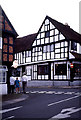
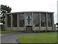
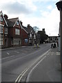
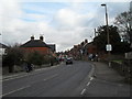
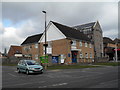
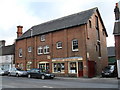
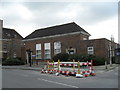
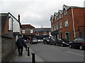
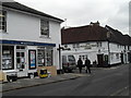
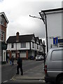
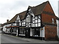
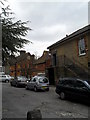
100 photos from this area
Area Information
Key information about the GU29 9JH including its size, population, and administrative classification.
- Area Type
- Postcode
- Area Size
- 6374 m²
- Population
- 1905
- Population Density
- 979 people/km²
House Prices in GU29 9JH
41
Properties
£336,038
Average Sold Price
£163,000
Lowest Price
£620,000
Highest Price
Showing 41 properties
| Address | Type | Beds | Baths | Last Sale Price | Last Sale Date | |
|---|---|---|---|---|---|---|
| 39 Petersfield Road, Midhurst, GU29 9JH | Terraced | 2 | 1 | £366,000 | Aug 2025 | |
| 21 Petersfield Road, Midhurst, GU29 9JH | Terraced | 3 | 1 | £325,000 | Jun 2025 | |
| 45 Petersfield Road, Midhurst, GU29 9JH | house | - | - | £303,000 | Nov 2023 | |
| Saxonbury, 55 Petersfield Road, Midhurst, GU29 9JH | Terraced | 4 | 1 | £520,000 | Sep 2021 | |
| 23 Petersfield Road, Midhurst, GU29 9JH | Terraced | 3 | - | £385,000 | Mar 2021 | |
| 19 Petersfield Road, Midhurst, GU29 9JH | Terraced | 2 | 1 | £240,000 | Feb 2021 | |
| Lynton, 61 Petersfield Road, Midhurst, GU29 9JH | Terraced | 3 | 1 | £360,000 | Sep 2020 | |
| 53 Petersfield Road, Midhurst, GU29 9JH | Detached | 4 | 1 | £620,000 | Jun 2018 | |
| 29 Petersfield Road, Midhurst, GU29 9JH | Terraced | 2 | 2 | £290,000 | Feb 2017 | |
| 65 Petersfield Road, Midhurst, GU29 9JH | Terraced | 3 | 1 | £323,000 | Jan 2016 |
Page 1 of 5
Energy Efficiency in GU29 9JH
Amenities
Schools
| Rank | School | Type | Entry gender | Ages |
|---|
Explore more schools in this area
Go to Schools tabDemographics
Household Size
One person
most common
Accommodation Type
Houses
most common
Tenure
61
majority
Ethnic Group
White
most common
Religion
N/A
most common
Household Composition
N/A
most common
Age
47
median
Adults (30-64 years)
most common
Household Deprivation
N/A
with no deprivation
NS-SEC
40
in Lower managerial occupations
Explore more demographic insights in this area
Go to Demographics tabPlanning
Planning Constraints
- Flood RiskPremium
- Ramsar Wetland SitesPremium
- Area of Outstanding Natural BeautyPremium
- Protected Nature ReservePremium
- Protected WoodlandPremium