Area Overview for GU29 9EP
Photos of GU29 9EP
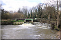
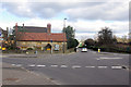
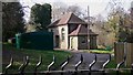
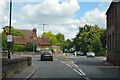
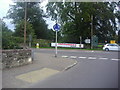
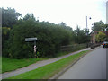

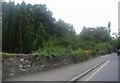
19 photos from this area
Area Information
Key information about the GU29 9EP including its size, population, and administrative classification.
- Area Type
- Postcode
- Area Size
- 36.7 hectares
- Population
- 1905
- Population Density
- 979 people/km²
House Prices in GU29 9EP
22
Properties
£234,500
Average Sold Price
£89,000
Lowest Price
£325,000
Highest Price
Showing 22 properties
| Address | Type | Beds | Baths | Last Sale Price | Last Sale Date | |
|---|---|---|---|---|---|---|
| 9 Nine Acres, Midhurst, GU29 9EP | Semi-detached | 3 | - | £325,000 | Sep 2016 | |
| 17 Nine Acres, Midhurst, GU29 9EP | house | 3 | - | £288,000 | Jun 2011 | |
| 13 Nine Acres, Midhurst, GU29 9EP | Semi-detached | - | - | £272,000 | Jul 2007 | |
| 12 Nine Acres, Midhurst, GU29 9EP | Semi-detached | 3 | 1 | £225,000 | Sep 2006 | |
| 7 Nine Acres, Midhurst, GU29 9EP | Semi-detached | - | - | £208,000 | Apr 2003 | |
| 16 Nine Acres, Midhurst, GU29 9EP | Semi-detached | - | - | £89,000 | May 1996 | |
| 14 Nine Acres, Midhurst, GU29 9EP | Retail | 3 | 1 | - | - | |
| 3 Nine Acres, Midhurst, GU29 9EP | Flat | - | - | - | - | |
| 19 Nine Acres, Midhurst, GU29 9EP | Flat | - | - | - | - | |
| 8 Nine Acres, Midhurst, GU29 9EP | Semi-detached | - | - | - | - |
Page 1 of 3
Energy Efficiency in GU29 9EP
Amenities
Schools
| Rank | School | Type | Entry gender | Ages |
|---|
Explore more schools in this area
Go to Schools tabDemographics
Household Size
One person
most common
Accommodation Type
Houses
most common
Tenure
61
majority
Ethnic Group
White
most common
Religion
N/A
most common
Household Composition
N/A
most common
Age
47
median
Adults (30-64 years)
most common
Household Deprivation
N/A
with no deprivation
NS-SEC
40
in Lower managerial occupations
Explore more demographic insights in this area
Go to Demographics tabPlanning
Planning Constraints
- Flood RiskPremium
- Ramsar Wetland SitesPremium
- Area of Outstanding Natural BeautyPremium
- Protected Nature ReservePremium
- Protected WoodlandPremium