Area Overview for GU29 9AD
Photos of GU29 9AD
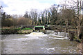


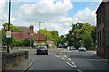
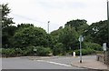
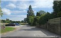

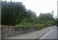
19 photos from this area
Area Information
Key information about the GU29 9AD including its size, population, and administrative classification.
- Area Type
- Postcode
- Area Size
- 12.7 hectares
- Population
- 1588
- Population Density
- 240 people/km²
House Prices in GU29 9AD
29
Properties
£665,235
Average Sold Price
£62,000
Lowest Price
£1,092,500
Highest Price
Showing 29 properties
| Address | Type | Beds | Baths | Last Sale Price | Last Sale Date | |
|---|---|---|---|---|---|---|
| Suffield House, Hollist Lane, Easebourne, GU29 9AD | Detached | 4 | 3 | £1,092,500 | Oct 2024 | |
| Rotherlea Cottage, Hollist Lane, Easebourne, GU29 9AD | house | - | - | £62,000 | Feb 2022 | |
| Fernhill, Hollist Lane, Easebourne, GU29 9AD | Bungalow | - | - | £770,000 | Aug 2021 | |
| Rivendell, Hollist Lane, Easebourne, GU29 9AD | Detached | 5 | 3 | £995,000 | Nov 2020 | |
| Dawslea Cottage, Hollist Lane, Easebourne, GU29 9AD | Detached | 4 | 2 | £872,000 | Jun 2018 | |
| Beeches, Hollist Lane, Easebourne, GU29 9AD | house | - | - | £780,000 | Sep 2016 | |
| Magnolia House, Hollist Lane, Easebourne, GU29 9AD | Detached | 5 | - | £900,000 | Jun 2014 | |
| Whitelands, Hollist Lane, Easebourne, GU29 9AD | Detached | 5 | - | £900,000 | Feb 2014 | |
| Orchard House, Hollist Lane, Easebourne, GU29 9AD | Detached | 4 | - | £775,000 | Dec 2013 | |
| Westlands, Hollist Lane, Easebourne, GU29 9AD | Detached | 5 | 4 | £640,000 | Oct 2013 |
Page 1 of 3
Energy Efficiency in GU29 9AD
Amenities
Schools
| Rank | School | Type | Entry gender | Ages |
|---|
Explore more schools in this area
Go to Schools tabDemographics
Household Size
Two person
most common
Accommodation Type
Houses
most common
Tenure
72
majority
Ethnic Group
White
most common
Religion
N/A
most common
Household Composition
N/A
most common
Age
47
median
Adults (30-64 years)
most common
Household Deprivation
N/A
with no deprivation
NS-SEC
45
in Lower managerial occupations
Explore more demographic insights in this area
Go to Demographics tabPlanning
Planning Constraints
- Flood RiskPremium
- Ramsar Wetland SitesPremium
- Area of Outstanding Natural BeautyPremium
- Protected Nature ReservePremium
- Protected WoodlandPremium