Area Overview for GU29 0LU
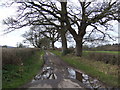
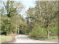
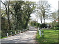
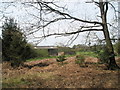
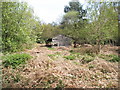
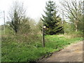
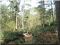
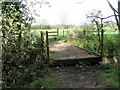
Photos of GU29 0LU


Area Information
Living in GU29 0LU means inhabiting a small, tightly knit residential cluster in England. The area covers 18.4 hectares and is home to 1,234 residents, translating to a low population density of 47 people per square kilometre. This suggests a quiet, spread-out community where neighbours are likely to know each other. The area’s compact size means it is not densely developed, offering a sense of space without the congestion of larger towns. With a median age of 47 and a majority of residents aged 30–64, the population skews towards adults, indicating a stable, mature demographic. This is a place where homeownership is prevalent—70% of properties are owner-occupied—suggesting long-term residency and a focus on family living. The presence of two schools, including a primary school with a satisfactory Ofsted rating, adds to the area’s appeal for families. While the postcode is small, its proximity to retail hubs like Sainsburys Midhurst and Tesco Midhurst ensures everyday needs are met without long commutes. For those seeking a low-key, family-friendly environment with a mix of residential tranquility and accessible amenities, GU29 0LU offers a distinct balance.
- Area Type
- Postcode
- Area Size
- 18.4 hectares
- Population
- 1234
- Population Density
- 47 people/km²
The property market in GU29 0LU is characterised by high homeownership, with 70% of properties owned by residents rather than rented out. This suggests a market skewed towards long-term residents rather than short-term renters, which can stabilise property values but may limit availability for new buyers. The accommodation type is predominantly houses, reflecting the area’s low population density and the typical footprint of residential clusters. This means the housing stock is likely to include larger properties with gardens, appealing to families or those seeking space. However, the small size of the area—just 18.4 hectares—implies limited new development, which could make the market competitive for buyers. For those considering the area, the focus on owner-occupied homes means rental options are scarce, and property prices may be influenced by the scarcity of available homes. The presence of nearby retail amenities and schools also adds to the area’s appeal, though buyers should consider the limited scale of the neighbourhood when assessing long-term prospects.
House Prices in GU29 0LU
Showing 4 properties
| Address | Type | Beds | Baths | Last Sale Price | Last Sale Date | |
|---|---|---|---|---|---|---|
| Tyelands Cottage, Severals Road, Bepton, GU29 0LU | house | - | - | £2,200,000 | Jan 2023 | |
| Woodlands Cottage, Severals Road, Bepton, GU29 0LU | Detached | - | - | £290,000 | May 1999 | |
| 15, Tylands Cottages, Severals Road, Bepton, GU29 0LU | Detached | - | - | - | - | |
| Tyelands Farm, Bepton Road, Bepton, GU29 0LU | Farm | - | - | - | - |
Energy Efficiency in GU29 0LU
The lifestyle in GU29 0LU is defined by its proximity to essential retail amenities and a low-key, residential character. Within practical reach are Sainsburys Midhurst, Spar, and Tesco Midhurst, providing access to groceries, household goods, and everyday conveniences without the need for lengthy trips. These stores cater to both daily needs and occasional shopping, supporting a self-contained lifestyle. The area’s small size and sparse development mean there are no large supermarkets or malls, but the existing retail options are sufficient for a modest, community-focused existence. Beyond shopping, the lack of detailed data on parks, leisure facilities, or dining options suggests that recreational activities may be limited to nearby natural spaces or the amenities of Midhurst itself. For residents valuing convenience and a quiet environment, the availability of nearby shops and the absence of urban sprawl contribute to a simple, functional lifestyle. However, those seeking a wider range of cultural or leisure activities may need to look beyond the immediate area.
Amenities
Schools
Residents of GU29 0LU have access to two schools within practical reach. Stedham Primary School, a primary school with an Ofsted rating of satisfactory, serves younger children, offering a foundation for early education. Nearby is St Cuthman’s School, Stedham, a special school catering to students with specific educational needs. This combination of school types provides families with options depending on their children’s requirements, though the absence of secondary schools in the immediate area may necessitate travel for older students. The presence of a special school highlights the area’s commitment to inclusive education, while the primary school’s satisfactory rating indicates a baseline level of performance. For parents prioritising proximity to educational facilities, the availability of these schools is a key consideration. However, the lack of comprehensive school data—such as exam results or Ofsted inspections for the special school—means further research would be needed to assess their full quality.
| Rank | School | Type | Entry gender | Ages |
|---|
Explore more schools in this area
Go to Schools tabDemographics
The community in GU29 0LU is predominantly composed of adults aged 30–64, with a median age of 47. This suggests a population that is largely settled, with fewer young families or elderly residents compared to other areas. Homeownership is high, with 70% of properties owned by residents, indicating a stable, long-term demographic. The accommodation type is primarily houses, which aligns with the area’s low population density and suggests a focus on single-family living rather than flats or shared housing. The predominant ethnic group is White, and no specific data on deprivation or diversity is provided, though the low population density and high homeownership may imply a relatively affluent or middle-income community. The absence of significant demographic diversity or younger residents could mean the area lacks the vibrancy of more multicultural or rapidly growing neighbourhoods. However, the stability of the population—combined with the presence of schools and retail amenities—suggests a functional, if unchanging, local environment.
Household Size
Accommodation Type
Tenure
Ethnic Group
Religion
Household Composition
Age
Household Deprivation
NS-SEC
Explore more demographic insights in this area
Go to Demographics tabPlanning
Planning Constraints
- Flood RiskPremium
- Ramsar Wetland SitesPremium
- Area of Outstanding Natural BeautyPremium
- Protected Nature ReservePremium
- Protected WoodlandPremium