Area Overview for GU29 0LR
Photos of GU29 0LR

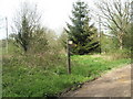
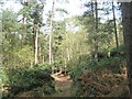
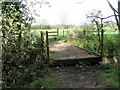
40 photos from this area
Area Information
Key information about the GU29 0LR including its size, population, and administrative classification.
- Area Type
- Postcode
- Area Size
- 57.8 hectares
- Population
- 1234
- Population Density
- 47 people/km²
House Prices in GU29 0LR
21
Properties
£675,929
Average Sold Price
£170,000
Lowest Price
£1,400,000
Highest Price
Showing 21 properties
| Address | Type | Beds | Baths | Last Sale Price | Last Sale Date | |
|---|---|---|---|---|---|---|
| 7 Severals Road, Bepton, GU29 0LR | Semi-detached | 3 | 1 | £485,000 | Jul 2024 | |
| Marwood, Severals Road, Bepton, GU29 0LR | Bungalow | 4 | 3 | £1,075,000 | Jun 2023 | |
| Burgrove, Severals Road, Bepton, GU29 0LR | Bungalow | - | - | £1,400,000 | Jan 2022 | |
| 1, Pinehurst Cottages, Severals Road, Bepton, GU29 0LR | Semi-detached | 3 | 1 | £582,500 | Sep 2021 | |
| Stickledown, Severals Road, Bepton, GU29 0LR | Bungalow | - | - | £565,000 | Mar 2018 | |
| The Paddock, Severals Road, Bepton, GU29 0LR | Detached | 3 | 1 | £532,500 | Aug 2017 | |
| New Cottage, Severals Road, Bepton, GU29 0LR | Detached | 3 | - | £720,000 | Mar 2016 | |
| Oakwood House, Severals Road, Bepton, GU29 0LR | Detached | 5 | 4 | £1,225,000 | Aug 2015 | |
| Tyelands, Severals Road, Bepton, GU29 0LR | house | 4 | - | £551,150 | Nov 2005 | |
| Pinecroft, Severals Road, Bepton, GU29 0LR | Detached | 4 | - | £430,000 | Jan 2005 |
Page 1 of 3
Energy Efficiency in GU29 0LR
Amenities
Schools
| Rank | School | Type | Entry gender | Ages |
|---|
Explore more schools in this area
Go to Schools tabDemographics
Household Size
Two person
most common
Accommodation Type
Houses
most common
Tenure
70
majority
Ethnic Group
White
most common
Religion
N/A
most common
Household Composition
N/A
most common
Age
47
median
Adults (30-64 years)
most common
Household Deprivation
N/A
with no deprivation
NS-SEC
42
in Lower managerial occupations
Explore more demographic insights in this area
Go to Demographics tabPlanning
Planning Constraints
- Flood RiskPremium
- Ramsar Wetland SitesPremium
- Area of Outstanding Natural BeautyPremium
- Protected Nature ReservePremium
- Protected WoodlandPremium