Area Overview for GU29 0EG
Photos of GU29 0EG
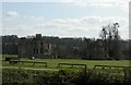
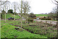
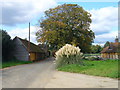
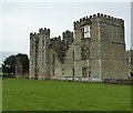
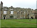

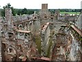
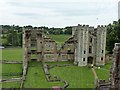
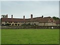
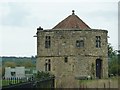
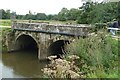
65 photos from this area
Area Information
Key information about the GU29 0EG including its size, population, and administrative classification.
- Area Type
- Postcode
- Area Size
- 18.9 hectares
- Population
- 1031
- Population Density
- 47 people/km²
House Prices in GU29 0EG
11
Properties
£683,800
Average Sold Price
£365,000
Lowest Price
£972,000
Highest Price
Showing 11 properties
| Address | Type | Beds | Baths | Last Sale Price | Last Sale Date | |
|---|---|---|---|---|---|---|
| Lavington Cottage, Selham Road, West Lavington, GU29 0EG | Bungalow | 3 | 2 | £972,000 | Feb 2025 | |
| St Andrews, Selham Road, West Lavington, GU29 0EG | Detached | 3 | 2 | £935,000 | Feb 2019 | |
| Hadden Lodge, Selham Road, West Lavington, GU29 0EG | Bungalow | 3 | - | £740,000 | Jul 2012 | |
| Southernwood, Selham Road, West Lavington, GU29 0EG | Detached | - | - | £365,000 | May 2002 | |
| Bywood, Selham Road, West Lavington, GU29 0EG | Detached | - | - | £407,000 | Feb 2001 | |
| Selham House, Selham Road, West Lavington, GU29 0EG | Detached | 3 | - | - | - | |
| Highstanding Farmhouse, Selham Road, West Lavington, GU29 0EG | house | - | - | - | - | |
| Highstanding Stable, Selham Road, West Lavington, GU29 0EG | Farm | - | - | - | - | |
| Mulberry Cottage, Selham Road, West Lavington, GU29 0EG | Detached | - | - | - | - | |
| Costers Farm, Selham Road, West Lavington, GU29 0EG | Detached | - | - | - | - |
Page 1 of 2
Energy Efficiency in GU29 0EG
Amenities
Schools
| Rank | School | Type | Entry gender | Ages |
|---|
Explore more schools in this area
Go to Schools tabDemographics
Household Size
Two person
most common
Accommodation Type
Houses
most common
Tenure
68
majority
Ethnic Group
White
most common
Religion
N/A
most common
Household Composition
N/A
most common
Age
47
median
Adults (30-64 years)
most common
Household Deprivation
N/A
with no deprivation
NS-SEC
43
in Lower managerial occupations
Explore more demographic insights in this area
Go to Demographics tabPlanning
Planning Constraints
- Flood RiskPremium
- Ramsar Wetland SitesPremium
- Area of Outstanding Natural BeautyPremium
- Protected Nature ReservePremium
- Protected WoodlandPremium