Area Overview for GU28 9JS
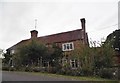
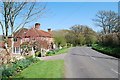
Photos of GU28 9JS


Area Information
GU28 9JS is a small, tightly knit residential area in England, covering just 4.9 hectares and home to 1599 residents. Its low population density of 40 people per square kilometre suggests a quiet, perhaps rural or semi-rural setting, where neighbours are likely to know each other. The area’s compact size means it is likely to be a self-contained community, possibly centred around a village or hamlet. With a median age of 47, the population skews towards middle-aged adults, many of whom are likely to be long-term residents. Daily life here would revolve around local amenities, nearby schools, and easy access to rail connections. The absence of significant environmental constraints or flood risks adds to its appeal as a stable, low-maintenance place to live. For those seeking a peaceful, close-knit environment with practical infrastructure, GU28 9JS offers a blend of simplicity and accessibility, though its small size means it is not suited to those needing extensive commercial or cultural facilities.
- Area Type
- Postcode
- Area Size
- 4.9 hectares
- Population
- 1599
- Population Density
- 40 people/km²
The property market in GU28 9JS is defined by a high rate of home ownership (60%) and a predominance of houses over flats. This suggests a market skewed towards owner-occupied properties, likely with a mix of older, established homes and newer builds. Given the area’s small size and low population density, the housing stock is likely limited, meaning buyers may need to consider nearby areas for more options. The focus on houses rather than apartments indicates a preference for private, low-density living, which could appeal to families or individuals seeking space and tranquillity. However, the small size of the postcode area means that property availability is constrained, and buyers should be prepared to look beyond GU28 9JS for larger selections. The market is likely to be competitive for those seeking specific types of homes, though the absence of major planning constraints or environmental risks may make it an attractive, stable option for long-term investment.
House Prices in GU28 9JS
Showing 1 properties
| Address | Type | Beds | Baths | Last Sale Price | Last Sale Date | |
|---|---|---|---|---|---|---|
| Box Cottage, Balls Cross Road, Balls Cross, Petworth, GU28 9JS | Detached | 4 | 2 | £520,000 | Sep 2013 |
Energy Efficiency in GU28 9JS
The lifestyle in GU28 9JS is shaped by its proximity to small-scale retail and transport hubs. Within practical reach are five retail outlets, including Spar and Co-op stores at Petworth and Billingshurst, providing access to everyday essentials. These shops likely serve both local needs and those of nearby areas, making the area convenient for errands and groceries. The two railway stations—Pulborough and Billingshurst—offer connectivity to broader networks, enabling residents to travel for work, shopping, or leisure. While the area’s small size means it lacks large-scale amenities like cinemas or supermarkets, the availability of basic retail and transport options supports a self-sufficient lifestyle. The character of the area is likely rural or semi-rural, with a focus on local services and community ties. For those prioritising simplicity and practicality over urban conveniences, GU28 9JS offers a straightforward, accessible way of life.
Amenities
Schools
Residents of GU28 9JS have access to two primary schools within practical reach: Petworth Cof E Primary School, which holds an Ofsted rating of ‘good’, and Herbert Shiner School. Both institutions cater to younger children, ensuring families have options for early education. The presence of two primary schools suggests a focus on localised schooling, which is typical for smaller communities. However, the data does not specify the size or capacity of these schools, so prospective homebuyers should investigate further to understand whether they meet the needs of growing families. The absence of secondary schools in the immediate area means that students may need to travel to nearby towns for higher education, but the proximity to rail stations like Billingshurst and Pulborough could ease this transition. For families prioritising primary education, the availability of two schools is a key consideration.
| Rank | School | Type | Entry gender | Ages |
|---|
Explore more schools in this area
Go to Schools tabDemographics
The community in GU28 9JS is predominantly composed of adults aged 30–64, with a median age of 47. This suggests a population that is largely in their prime working years, likely with established careers and family commitments. Home ownership is strong, with 60% of residents owning their homes, indicating a stable, long-term demographic. The area is characterised by houses rather than flats, which aligns with the typical housing stock of rural or semi-rural communities. The predominant ethnic group is White, though no specific data on diversity or deprivation is provided. The low population density of 40 people per square kilometre implies a spread-out, possibly suburban or village-like layout, where social interactions are likely to be localised. This profile suggests a community that values stability, privacy, and proximity to nature, with limited pressure from urbanisation or overcrowding.
Household Size
Accommodation Type
Tenure
Ethnic Group
Religion
Household Composition
Age
Household Deprivation
NS-SEC
Explore more demographic insights in this area
Go to Demographics tabPlanning
Planning Constraints
- Flood RiskPremium
- Ramsar Wetland SitesPremium
- Area of Outstanding Natural BeautyPremium
- Protected Nature ReservePremium
- Protected WoodlandPremium