Area Overview for GU28 9JU
Photos of GU28 9JU
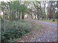
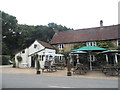
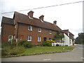
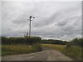
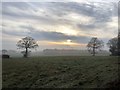
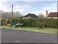
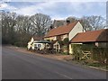
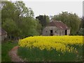
37 photos from this area
Area Information
Key information about the GU28 9JU including its size, population, and administrative classification.
- Area Type
- Postcode
- Area Size
- 1.2 km²
- Population
- 1599
- Population Density
- 40 people/km²
House Prices in GU28 9JU
12
Properties
£606,750
Average Sold Price
£145,000
Lowest Price
£1,000,000
Highest Price
Showing 12 properties
| Address | Type | Beds | Baths | Last Sale Price | Last Sale Date | |
|---|---|---|---|---|---|---|
| China Bridge House, Ebernoe Road, Balls Cross, Ebernoe, GU28 9JU | Detached | 2 | 2 | £420,000 | Mar 2023 | |
| Birchwood, Ebernoe Road, Balls Cross, Ebernoe, GU28 9JU | Detached | 4 | 4 | £1,000,000 | Mar 2023 | |
| 1, Capels Cottages, Ebernoe Road, Balls Cross, Ebernoe, GU28 9JU | house | 2 | - | £675,500 | Sep 2022 | |
| Bittlesfield, Ebernoe Road, Balls Cross, Ebernoe, GU28 9JU | house | - | - | £950,000 | Oct 2019 | |
| Ivy Cottage, Ebernoe Road, Balls Cross, Ebernoe, GU28 9JU | Detached | - | - | £450,000 | Jun 2016 | |
| Copseside, Ebernoe Road, Balls Cross, Ebernoe, GU28 9JU | Detached | - | - | £145,000 | May 2002 | |
| High Buildings Barn, Ebernoe Road, Balls Cross, Ebernoe, GU28 9JU | Detached | 4 | 4 | - | - | |
| Burchwells, Ebernoe Road, Balls Cross, Ebernoe, GU28 9JU | Detached | 4 | - | - | - | |
| High Buildings Farm, Ebernoe Road, Balls Cross, Ebernoe, GU28 9JU | Farm | - | - | - | - | |
| Sparkes Farm, Ebernoe Road, Balls Cross, Ebernoe, GU28 9JU | Farm | - | - | - | - |
Page 1 of 2
Energy Efficiency in GU28 9JU
Amenities
Schools
| Rank | School | Type | Entry gender | Ages |
|---|
Explore more schools in this area
Go to Schools tabDemographics
Household Size
Two person
most common
Accommodation Type
Houses
most common
Tenure
60
majority
Ethnic Group
White
most common
Religion
N/A
most common
Household Composition
N/A
most common
Age
47
median
Adults (30-64 years)
most common
Household Deprivation
N/A
with no deprivation
NS-SEC
38
in Lower managerial occupations
Explore more demographic insights in this area
Go to Demographics tabPlanning
Planning Constraints
- Flood RiskPremium
- Ramsar Wetland SitesPremium
- Area of Outstanding Natural BeautyPremium
- Protected Nature ReservePremium
- Protected WoodlandPremium