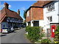
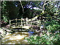
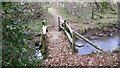
Area Overview for GU28 0BW
Photos of GU28 0BW


Area Information
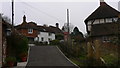
GU28 0BW is a small residential postcode in England, spanning 8,780 square metres and home to 1,599 residents. Its low population density of 40 people per square kilometre suggests a quiet, spread-out community. The area is characterised by a predominance of houses, with 60% of properties owner-occupied. This reflects a stable, long-term demographic, with the median age at 47 and the majority of residents aged between 30 and 64. Daily life here is likely to be low-key, with a focus on local amenities and nearby towns. The proximity to Petworth Cof E Primary School and Herbert Shiner School makes it appealing for families, while the nearby Co-op Petworth and Tesco Pulborough offer essential shopping. The single railway station at Pulborough adds connectivity to the region. For those seeking a peaceful, family-friendly environment with a mix of retail and transport options, GU28 0BW provides a compact, self-contained living experience.
- Area Type
- Postcode
- Area Size
- 8780 m²
- Population
- 1599
- Population Density
- 40 people/km²
The property market in GU28 0BW is dominated by owner-occupied homes, with 60% of properties in private hands. The area’s housing stock consists largely of houses, which is typical for smaller, residential postcode clusters. This suggests a market geared towards long-term residents rather than short-term rentals. The small size of the area, combined with the predominance of houses, may limit the number of available properties, making it a niche market for buyers seeking a specific type of home. Those considering the area should factor in the need to look beyond the immediate postcode for broader options, as the local stock is likely to be limited. The low population density also implies a more spread-out housing layout, which could appeal to those prioritising space and tranquillity.
House Prices in GU28 0BW
Showing 8 properties
| Address | Type | Beds | Baths | Last Sale Price | Last Sale Date | |
|---|---|---|---|---|---|---|
| Fieldings, Sheepdown Drive, Petworth, GU28 0BW | Detached | 5 | 3 | £710,000 | Nov 2019 | |
| Woodbridge, 39 Sheepdown Drive, Petworth, GU28 0BW | Detached | 4 | 2 | - | - | |
| 28 Sheepdown Drive, Petworth, GU28 0BW | house | - | - | - | - | |
| Tupp End, Sheepdown Drive, Petworth, GU28 0BW | Detached | - | - | - | - | |
| Westbury, Sheepdown Drive, Petworth, GU28 0BW | Detached | - | - | - | - | |
| 22 Sheepdown Drive, Petworth, GU28 0BW | Semi-detached | - | - | - | - | |
| 24 Sheepdown Drive, Petworth, GU28 0BW | Bungalow | - | - | - | - | |
| 26 Sheepdown Drive, Petworth, GU28 0BW | house | - | - | - | - |
Energy Efficiency in GU28 0BW
Residents of GU28 0BW have access to a range of local amenities, including five retail outlets such as Co-op Petworth, Tesco Pulborough, and Spar. These shops provide convenience for everyday needs, from groceries to essentials. The nearby Pulborough Railway Station adds to the area’s connectivity, enabling travel to larger towns for additional services. While the data does not mention parks or leisure facilities, the presence of retail and transport options suggests a lifestyle that prioritises practicality and ease of access. The small-scale nature of the area means amenities are likely to be compact but sufficient for daily living, with the railway station serving as a gateway to broader opportunities.
Amenities
Schools
GU28 0BW is served by two primary schools: Petworth Cof E Primary School, which holds an Ofsted rating of ‘good’, and Herbert Shiner School. Both institutions cater to younger children, providing families with accessible options for early education. The presence of two primary schools within practical reach suggests a focus on supporting local families, though secondary education may require travel to nearby towns. The ‘good’ rating at Petworth Cof E Primary indicates a school that meets or exceeds standards in teaching and pupil outcomes. For parents prioritising proximity to schools, this area offers immediate access to primary education, though further research would be needed for secondary schooling.
| Rank | School | Type | Entry gender | Ages |
|---|
Explore more schools in this area
Go to Schools tabDemographics
The population of GU28 0BW is 1,599, with a median age of 47. The majority of residents fall within the 30-64 age range, indicating a community of working-age adults and older families. Home ownership is high at 60%, with houses being the primary accommodation type. The predominant ethnic group is White, and the low population density of 40 people per square kilometre suggests a less crowded, more spacious living environment. This demographic profile points to a mature, stable community with established households. The absence of specific data on deprivation means quality of life is inferred from the available figures: a low-risk area for safety and environmental factors, combined with accessible amenities. For buyers, this translates to a neighbourhood that balances privacy with proximity to essential services.
Household Size
Accommodation Type
Tenure
Ethnic Group
Religion
Household Composition
Age
Household Deprivation
NS-SEC
Explore more demographic insights in this area
Go to Demographics tabPlanning
Planning Constraints
- Flood RiskPremium
- Ramsar Wetland SitesPremium
- Area of Outstanding Natural BeautyPremium
- Protected Nature ReservePremium
- Protected WoodlandPremium