Area Overview for GU27 3FD
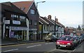
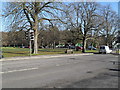
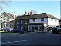
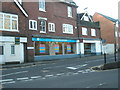
Photos of GU27 3FD


Area Information
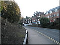
GU27 3FD is a compact residential postcode in England, covering 902 square metres and home to 1750 residents. Its high population density of 1,940,311 people per square kilometre reflects a tightly knit community, though the area’s small size means it is a focused cluster of homes rather than a sprawling suburb. Daily life here is shaped by its proximity to nearby towns and the presence of key infrastructure. The area is not defined by commercial hubs or industrial zones but by its residential character, with a mix of older and newer housing stock. Residents benefit from being close to essential services, including retail and transport links, while the surrounding landscape offers natural beauty. The area’s designation as part of an Area of Outstanding Natural Beauty adds a layer of environmental significance, though this does not detract from its practical appeal. For those seeking a quiet, community-oriented place to live with easy access to amenities, GU27 3FD offers a balance of convenience and tranquillity.
- Area Type
- Postcode
- Area Size
- 902 m²
- Population
- 1750
- Population Density
- 2771 people/km²
The property market in GU27 3FD is characterised by a 50% home ownership rate, with houses forming the predominant accommodation type. This indicates a community where owner-occupation is common, though not universal, and where rental options may be limited due to the area’s small size. The focus on houses rather than flats or apartments suggests a preference for single-family homes, which could appeal to buyers seeking space and privacy. However, the limited area size means the housing stock is not extensive, and buyers may find fewer properties available compared to larger towns. Those considering the area should also factor in its proximity to nearby amenities, which may influence property values. The market is likely to be competitive, with demand driven by the area’s practicality and access to transport links, though the small footprint means opportunities are constrained.
House Prices in GU27 3FD
Showing 9 properties
Energy Efficiency in GU27 3FD
Living in GU27 3FD offers access to essential retail and dining options, including Tesco Haslemere, M&S Haslemere SF, and Asda Haslemere, which provide a range of shopping and food services within practical reach. The area’s rail stations—Haslemere, Liphook, and Witley—facilitate easy travel to nearby towns and cities, enhancing both leisure and work opportunities. While the data does not specify parks or leisure facilities, the area’s inclusion within an Area of Outstanding Natural Beauty suggests nearby scenic spaces for outdoor activities. The presence of major retailers and transport links contributes to a convenient lifestyle, balancing daily necessities with the potential for exploring the surrounding countryside. Residents benefit from a mix of practical amenities and natural surroundings, supporting both routine living and occasional escapes.
Amenities
Schools
| Rank | School | Type | Entry gender | Ages |
|---|
Explore more schools in this area
Go to Schools tabDemographics
The population of GU27 3FD skews towards adults aged 30–64, with a median age of 47. This suggests a mature, stable community with fewer young families or retirees compared to other areas. Home ownership rates stand at 50%, indicating a mix of owner-occupied and rented properties. The predominant accommodation type is houses, which aligns with the area’s residential character. The majority of residents identify as White, though no specific data on other ethnic groups is provided. The absence of detailed diversity statistics means the community’s cultural composition remains less defined in the data. With no mention of deprivation levels, it is unclear how economic factors influence quality of life, but the age profile and housing stock suggest a relatively settled population with established routines and long-term residency.
Household Size
Accommodation Type
Tenure
Ethnic Group
Religion
Household Composition
Age
Household Deprivation
NS-SEC
Explore more demographic insights in this area
Go to Demographics tabPlanning
Planning Constraints
- Flood RiskPremium
- Ramsar Wetland SitesPremium
- Area of Outstanding Natural BeautyPremium
- Protected Nature ReservePremium
- Protected WoodlandPremium