Area Overview for GU26 6HY
Photos of GU26 6HY
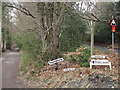
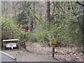
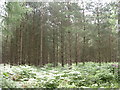
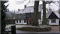
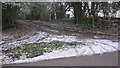
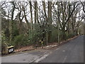
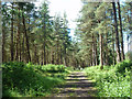
11 photos from this area
Area Information
Key information about the GU26 6HY including its size, population, and administrative classification.
- Area Type
- Postcode
- Area Size
- 10.4 hectares
- Population
- 1288
- Population Density
- 556 people/km²
House Prices in GU26 6HY
15
Properties
£853,214
Average Sold Price
£250,000
Lowest Price
£2,035,000
Highest Price
Showing 15 properties
| Address | Type | Beds | Baths | Last Sale Price | Last Sale Date | |
|---|---|---|---|---|---|---|
| Maymoon, Churt Road, Hindhead, GU26 6HY | Detached | - | - | £2,035,000 | Apr 2021 | |
| Noddon, Churt Road, Hindhead, GU26 6HY | Detached | 4 | 2 | £1,272,000 | Feb 2021 | |
| Larch House, Churt Road, Hindhead, GU26 6HY | house | 5 | - | £935,000 | Feb 2021 | |
| Pine House Cottage, Churt Road, Hindhead, GU26 6HY | Detached | 3 | 2 | £499,000 | Aug 2006 | |
| Bucklands Cottage, Churt Road, Hindhead, GU26 6HY | house | - | - | £250,000 | Mar 1999 | |
| Green Ridges, Churt Road, Hindhead, GU26 6HY | Detached | - | - | £495,000 | May 1998 | |
| The Square House, Churt Road, Hindhead, GU26 6HY | Detached | - | - | £486,500 | Dec 1996 | |
| Pine House, Churt Road, Hindhead, GU26 6HY | Detached | 6 | 3 | - | - | |
| Tennis 72M From Combe End, Whitmore Vale Road 28M From Whitmoor Vale Road, Whitmore Vale Road, Hindhead, GU26 6HY | Leisure | - | - | - | - | |
| Tennis 51M From Hatch Hill House, Churt Road 52M From A287, Churt Road, Churt, Farnham, GU26 6HY | Leisure | - | - | - | - |
Page 1 of 2
Energy Efficiency in GU26 6HY
Amenities
Schools
| Rank | School | Type | Entry gender | Ages |
|---|
Explore more schools in this area
Go to Schools tabDemographics
Household Size
Family (3-5 people)
most common
Accommodation Type
Houses
most common
Tenure
85
majority
Ethnic Group
White
most common
Religion
N/A
most common
Household Composition
N/A
most common
Age
47
median
Adults (30-64 years)
most common
Household Deprivation
N/A
with no deprivation
NS-SEC
52
in Lower managerial occupations
Explore more demographic insights in this area
Go to Demographics tabPlanning
Planning Constraints
- Flood RiskPremium
- Ramsar Wetland SitesPremium
- Area of Outstanding Natural BeautyPremium
- Protected Nature ReservePremium
- Protected WoodlandPremium