Area Overview for GU26 6EY
Photos of GU26 6EY


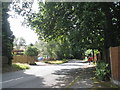
53 photos from this area
Area Information
Key information about the GU26 6EY including its size, population, and administrative classification.
- Area Type
- Postcode
- Area Size
- 1.7 hectares
- Population
- 1417
- Population Density
- 481 people/km²
House Prices in GU26 6EY
16
Properties
£607,281
Average Sold Price
£308,750
Lowest Price
£799,995
Highest Price
Showing 16 properties
| Address | Type | Beds | Baths | Last Sale Price | Last Sale Date | |
|---|---|---|---|---|---|---|
| Fairfield, Mowatt Road, Grayshott, Hindhead, GU26 6EY | Bungalow | 3 | 2 | £799,995 | Apr 2024 | |
| The Rowans, 4 Mowatt Road, Grayshott, Hindhead, GU26 6EY | Semi-detached | 3 | 1 | £685,000 | Jul 2023 | |
| Glenhurst, 8 Mowatt Road, Grayshott, Hindhead, GU26 6EY | Detached | 4 | 1 | £750,000 | Jun 2018 | |
| Bracken Hill, Mowatt Road, Grayshott, Hindhead, GU26 6EY | Detached | 3 | - | £750,000 | Oct 2014 | |
| Holmwood, 6 Mowatt Road, Grayshott, Hindhead, GU26 6EY | Detached | 4 | 2 | £715,000 | May 2014 | |
| St Marys, Mowatt Road, Grayshott, Hindhead, GU26 6EY | Bungalow | - | - | £400,000 | Aug 2009 | |
| Southwood, Mowatt Road, Grayshott, Hindhead, GU26 6EY | Bungalow | 4 | - | £449,500 | Aug 2007 | |
| Sunny Ridge, 1 Mowatt Road, Grayshott, Hindhead, GU26 6EY | Detached | 4 | 2 | £308,750 | Oct 2002 | |
| Seven, 7 Mowatt Road, Grayshott, Hindhead, GU26 6EY | Detached | 3 | 1 | - | - | |
| Chattan, Mowatt Road, Grayshott, Hindhead, GU26 6EY | Detached | - | - | - | - |
Page 1 of 2
Energy Efficiency in GU26 6EY
Amenities
Schools
| Rank | School | Type | Entry gender | Ages |
|---|
Explore more schools in this area
Go to Schools tabDemographics
Household Size
Two person
most common
Accommodation Type
Houses
most common
Tenure
89
majority
Ethnic Group
White
most common
Religion
N/A
most common
Household Composition
N/A
most common
Age
47
median
Adults (30-64 years)
most common
Household Deprivation
N/A
with no deprivation
NS-SEC
52
in Lower managerial occupations
Explore more demographic insights in this area
Go to Demographics tabPlanning
Planning Constraints
- Flood RiskPremium
- Ramsar Wetland SitesPremium
- Area of Outstanding Natural BeautyPremium
- Protected Nature ReservePremium
- Protected WoodlandPremium