Area Overview for GU26 6ER
Photos of GU26 6ER
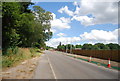
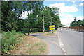
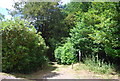
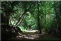
53 photos from this area
Area Information
Key information about the GU26 6ER including its size, population, and administrative classification.
- Area Type
- Postcode
- Area Size
- 8.2 hectares
- Population
- 1417
- Population Density
- 481 people/km²
House Prices in GU26 6ER
23
Properties
£822,500
Average Sold Price
£177,500
Lowest Price
£1,340,000
Highest Price
Showing 23 properties
| Address | Type | Beds | Baths | Last Sale Price | Last Sale Date | |
|---|---|---|---|---|---|---|
| Lavenders, 72 Kingswood Firs, Grayshott, Hindhead, GU26 6ER | Bungalow | 3 | 2 | £950,000 | Jul 2023 | |
| Forest Lodge, 69 Kingswood Firs, Grayshott, Hindhead, GU26 6ER | house | 5 | - | £1,340,000 | Dec 2014 | |
| Copse Wood, 56 Kingswood Firs, Grayshott, Hindhead, GU26 6ER | Bungalow | 5 | 4 | £177,500 | Sep 2002 | |
| Blencathera, 62 Kingswood Firs, Grayshott, Hindhead, GU26 6ER | Detached | 4 | 2 | - | - | |
| 71 Kingswood Firs, Grayshott, Hindhead, GU26 6ER | Bungalow | 5 | 2 | - | - | |
| Courtlands, 61 Kingswood Firs, Grayshott, Hindhead, GU26 6ER | Detached | 3 | 3 | - | - | |
| Woodland Manor, 70 Kingswood Firs, Grayshott, Hindhead, GU26 6ER | Detached | 6 | 4 | - | - | |
| Trees, 73 Kingswood Firs, Grayshott, Hindhead, GU26 6ER | Detached | 6 | 4 | - | - | |
| Crowsnest, 65 Kingswood Firs, Grayshott, Hindhead, GU26 6ER | Detached | 5 | 2 | - | - | |
| Little Acre, 54 Kingswood Firs, Grayshott, Hindhead, GU26 6ER | Bungalow | 4 | 2 | - | - |
Page 1 of 3
Energy Efficiency in GU26 6ER
Amenities
Schools
| Rank | School | Type | Entry gender | Ages |
|---|
Explore more schools in this area
Go to Schools tabDemographics
Household Size
Two person
most common
Accommodation Type
Houses
most common
Tenure
89
majority
Ethnic Group
White
most common
Religion
N/A
most common
Household Composition
N/A
most common
Age
47
median
Adults (30-64 years)
most common
Household Deprivation
N/A
with no deprivation
NS-SEC
52
in Lower managerial occupations
Explore more demographic insights in this area
Go to Demographics tabPlanning
Planning Constraints
- Flood RiskPremium
- Ramsar Wetland SitesPremium
- Area of Outstanding Natural BeautyPremium
- Protected Nature ReservePremium
- Protected WoodlandPremium