Area Overview for GU21 2SD
Photos of GU21 2SD
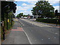
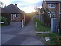
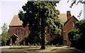
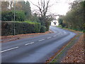
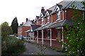
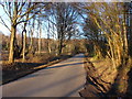
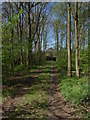
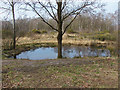
40 photos from this area
Area Information
Key information about the GU21 2SD including its size, population, and administrative classification.
- Area Type
- Postcode
- Area Size
- 1.5 hectares
- Population
- 2557
- Population Density
- 971 people/km²
House Prices in GU21 2SD
10
Properties
£451,143
Average Sold Price
£185,000
Lowest Price
£675,000
Highest Price
Showing 10 properties
| Address | Type | Beds | Baths | Last Sale Price | Last Sale Date | |
|---|---|---|---|---|---|---|
| The Shieling, Grindstone Handle Corner, Knaphill, Woking, GU21 2SD | Semi-detached | 3 | 1 | £675,000 | Oct 2025 | |
| Lane End, Grindstone Handle Corner, Knaphill, Woking, GU21 2SD | Semi-detached | 3 | 1 | £515,000 | Sep 2019 | |
| Imber Lodge, Grindstone Handle Corner, Knaphill, Woking, GU21 2SD | Bungalow | 4 | - | £660,000 | May 2017 | |
| Woodstock, Grindstone Handle Corner, Knaphill, Woking, GU21 2SD | Detached | 4 | 2 | £545,000 | Aug 2016 | |
| Tankards, Grindstone Handle Corner, Knaphill, Woking, GU21 2SD | Detached | 4 | 2 | £328,000 | Nov 2005 | |
| Agar, Grindstone Handle Corner, Knaphill, Woking, GU21 2SD | Semi-detached | - | - | £250,000 | Sep 2003 | |
| Eight, Grindstone Handle Corner, Knaphill, Woking, GU21 2SD | Detached | - | - | £185,000 | Feb 1998 | |
| L Ancresse, Grindstone Handle Corner, Knaphill, Woking, GU21 2SD | Bungalow | 3 | - | - | - | |
| Heathview, Grindstone Handle Corner, Knaphill, Woking, GU21 2SD | Detached | - | - | - | - | |
| Genestra, Grindstone Handle Corner, Knaphill, Woking, GU21 2SD | Bungalow | - | - | - | - |
Energy Efficiency in GU21 2SD
Amenities
Schools
| Rank | School | Type | Entry gender | Ages |
|---|
Explore more schools in this area
Go to Schools tabDemographics
Household Size
Family (3-5 people)
most common
Accommodation Type
Houses
most common
Tenure
88
majority
Ethnic Group
White
most common
Religion
N/A
most common
Household Composition
N/A
most common
Age
47
median
Adults (30-64 years)
most common
Household Deprivation
N/A
with no deprivation
NS-SEC
40
in Lower managerial occupations
Explore more demographic insights in this area
Go to Demographics tabPlanning
Planning Constraints
- Flood RiskPremium
- Ramsar Wetland SitesPremium
- Area of Outstanding Natural BeautyPremium
- Protected Nature ReservePremium
- Protected WoodlandPremium