Area Overview for GU21 2NW
Photos of GU21 2NW
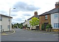

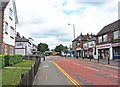
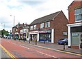
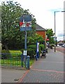
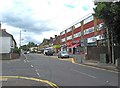
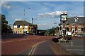
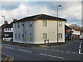
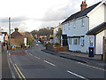
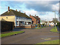
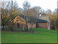
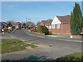
65 photos from this area
Area Information
Key information about the GU21 2NW including its size, population, and administrative classification.
- Area Type
- Postcode
- Area Size
- 1.7 hectares
- Population
- 1544
- Population Density
- 5738 people/km²
House Prices in GU21 2NW
40
Properties
£249,721
Average Sold Price
£54,000
Lowest Price
£425,000
Highest Price
Showing 40 properties
| Address | Type | Beds | Baths | Last Sale Price | Last Sale Date | |
|---|---|---|---|---|---|---|
| 64 Nursery Road, Knaphill, Woking, GU21 2NW | Semi-detached | 3 | 1 | £415,000 | Sep 2024 | |
| 69 Nursery Road, Knaphill, Woking, GU21 2NW | Semi-detached | 2 | 1 | £425,000 | Oct 2022 | |
| 51 Nursery Road, Knaphill, Woking, GU21 2NW | Terraced | 3 | 1 | £258,000 | Aug 2019 | |
| 70 Nursery Road, Knaphill, Woking, GU21 2NW | Semi-detached | 2 | 1 | £320,000 | Nov 2017 | |
| 55 Nursery Road, Knaphill, Woking, GU21 2NW | house | - | - | £335,000 | Aug 2016 | |
| 36 Nursery Road, Knaphill, Woking, GU21 2NW | Terraced | 3 | 1 | £300,000 | Dec 2015 | |
| 56 Nursery Road, Knaphill, Woking, GU21 2NW | Terraced | 3 | 1 | £245,000 | Nov 2014 | |
| 35 Nursery Road, Knaphill, Woking, GU21 2NW | Terraced | 3 | - | £265,000 | Oct 2014 | |
| 38 Nursery Road, Knaphill, Woking, GU21 2NW | Terraced | 2 | - | £250,000 | Jan 2013 | |
| 71 Nursery Road, Knaphill, Woking, GU21 2NW | Semi-detached | 3 | 2 | £236,000 | Oct 2012 |
Page 1 of 4
Energy Efficiency in GU21 2NW
Amenities
Schools
| Rank | School | Type | Entry gender | Ages |
|---|
Explore more schools in this area
Go to Schools tabDemographics
Household Size
Family (3-5 people)
most common
Accommodation Type
Houses
most common
Tenure
64
majority
Ethnic Group
White
most common
Religion
N/A
most common
Household Composition
N/A
most common
Age
47
median
Adults (30-64 years)
most common
Household Deprivation
N/A
with no deprivation
NS-SEC
34
in Lower managerial occupations
Explore more demographic insights in this area
Go to Demographics tabPlanning
Planning Constraints
- Flood RiskPremium
- Ramsar Wetland SitesPremium
- Area of Outstanding Natural BeautyPremium
- Protected Nature ReservePremium
- Protected WoodlandPremium