Area Overview for GU18 5YY
Photos of GU18 5YY
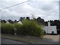
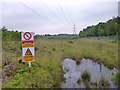
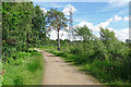
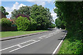

32 photos from this area
Area Information
Key information about the GU18 5YY including its size, population, and administrative classification.
- Area Type
- Postcode
- Area Size
- 1.3 hectares
- Population
- 1564
- Population Density
- 817 people/km²
House Prices in GU18 5YY
34
Properties
£296,253
Average Sold Price
£66,000
Lowest Price
£580,000
Highest Price
Showing 34 properties
| Address | Type | Beds | Baths | Last Sale Price | Last Sale Date | |
|---|---|---|---|---|---|---|
| 19 Ivy Drive, Lightwater, GU18 5YY | Terraced | 2 | 1 | £385,000 | Nov 2025 | |
| 33 Ivy Drive, Lightwater, GU18 5YY | Terraced | 3 | 1 | £390,000 | Oct 2025 | |
| 31 Ivy Drive, Lightwater, GU18 5YY | Terraced | 4 | 1 | £450,000 | Jan 2023 | |
| 21 Ivy Drive, Lightwater, GU18 5YY | Terraced | 2 | 1 | £380,000 | Oct 2022 | |
| 63 Ivy Drive, Lightwater, GU18 5YY | Terraced | 2 | 1 | £320,000 | Aug 2022 | |
| 65 Ivy Drive, Lightwater, GU18 5YY | house | - | - | £325,000 | Sep 2021 | |
| 53 Ivy Drive, Lightwater, GU18 5YY | Terraced | 2 | 1 | £275,000 | Sep 2020 | |
| 27 Ivy Drive, Lightwater, GU18 5YY | house | - | - | £340,000 | Jul 2020 | |
| 7 Ivy Drive, Lightwater, GU18 5YY | Detached | 4 | 2 | £580,000 | Jan 2020 | |
| 39 Ivy Drive, Lightwater, GU18 5YY | house | 2 | - | £343,000 | Nov 2017 |
Page 1 of 4
Energy Efficiency in GU18 5YY
Amenities
Schools
| Rank | School | Type | Entry gender | Ages |
|---|
Explore more schools in this area
Go to Schools tabDemographics
Household Size
Two person
most common
Accommodation Type
Houses
most common
Tenure
87
majority
Ethnic Group
White
most common
Religion
N/A
most common
Household Composition
N/A
most common
Age
47
median
Adults (30-64 years)
most common
Household Deprivation
N/A
with no deprivation
NS-SEC
54
in Lower managerial occupations
Explore more demographic insights in this area
Go to Demographics tabPlanning
Planning Constraints
- Flood RiskPremium
- Ramsar Wetland SitesPremium
- Area of Outstanding Natural BeautyPremium
- Protected Nature ReservePremium
- Protected WoodlandPremium