Area Overview for GU18 5YT
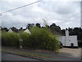
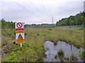
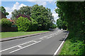
Photos of GU18 5YT


Area Information
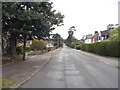
GU18 5YT is a small, tightly knit residential cluster in England, covering just 1.4 hectares and home to 1,564 residents. With a population density of 817 people per square kilometre, it’s a compact area where community life is likely to feel intimate. The postcode sits in a region that balances suburban convenience with proximity to transport links, making it appealing for those seeking a blend of quiet living and accessibility. Daily life here is shaped by its demographics: the majority of residents are adults aged 30–64, suggesting a mix of professionals, families, and retirees. The area’s modest size means amenities are within practical reach, and its low crime risk score of 89/100 reinforces a sense of security. While not a sprawling suburb, GU18 5YT offers a self-contained environment where neighbours are likely to know one another, and the local character is defined by its practical layout and straightforward needs.
- Area Type
- Postcode
- Area Size
- 1.4 hectares
- Population
- 1564
- Population Density
- 817 people/km²
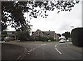
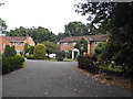
The property market in GU18 5YT is dominated by owner-occupied homes, with 87% of residents living in houses rather than flats or rented accommodation. This suggests a market that prioritises long-term residency over short-term rental opportunities. The prevalence of houses indicates a focus on family-friendly or semi-detached properties, which may appeal to those seeking space and privacy. Given the area’s small size, the housing stock is likely limited, meaning buyers should consider nearby suburbs for additional options. The high home ownership rate also implies that properties here may hold value over time, though the compact nature of the postcode means competition for available homes could be fierce. For buyers, this area offers a chance to invest in a stable, low-risk environment, but they should be prepared for a market that is not overly expansive.
House Prices in GU18 5YT
Showing 48 properties
| Address | Type | Beds | Baths | Last Sale Price | Last Sale Date | |
|---|---|---|---|---|---|---|
| 71 Ivy Drive, Lightwater, GU18 5YT | Flat | - | - | £325,000 | Mar 2025 | |
| 103 Ivy Drive, Lightwater, GU18 5YT | Flat | - | - | £260,000 | Dec 2024 | |
| 36 Ivy Drive, Lightwater, GU18 5YT | Flat | 1 | 1 | £220,000 | Aug 2024 | |
| 46 Ivy Drive, Lightwater, GU18 5YT | Flat | 1 | 1 | £240,000 | Apr 2024 | |
| 70 Ivy Drive, Lightwater, GU18 5YT | Flat | - | - | £224,500 | Jul 2023 | |
| 101 Ivy Drive, Lightwater, GU18 5YT | Flat | 2 | 1 | £289,950 | Feb 2023 | |
| 77 Ivy Drive, Lightwater, GU18 5YT | Flat | 1 | 1 | £250,000 | Oct 2022 | |
| 48 Ivy Drive, Lightwater, GU18 5YT | Flat | 1 | 1 | £220,000 | Oct 2021 | |
| 60 Ivy Drive, Lightwater, GU18 5YT | Flat | 1 | 1 | £230,000 | Sep 2021 | |
| 79 Ivy Drive, Lightwater, GU18 5YT | Flat | 2 | 1 | £250,000 | Aug 2021 |
Energy Efficiency in GU18 5YT
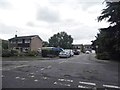
Living in GU18 5YT offers access to a range of nearby amenities that cater to everyday needs. Retail options include Co-op Guildford, Cook Lightwater, and M&S Lightwater BP, providing a mix of grocery and convenience shopping. The proximity to multiple railway stations—Bagshot, Camberley, and Brookwood—ensures easy access to public transport, whether for commuting or weekend trips. Fairoaks Airport is also within reach, adding to the area’s connectivity. While the postcode itself is small, its immediate surroundings offer a practical balance of retail, transport, and leisure options. The presence of these amenities means residents can manage daily errands without lengthy journeys, contributing to a convenient, low-stress lifestyle. The character of the area is defined by its straightforward, functional approach to living, with no unnecessary frills but all essential services accounted for.
Amenities
Schools
| Rank | School | Type | Entry gender | Ages |
|---|
Explore more schools in this area
Go to Schools tabDemographics
The community in GU18 5YT is predominantly composed of adults aged 30–64, with a median age of 47. This suggests a population skewed towards middle-aged individuals, many of whom may be in their peak working years or raising families. Home ownership is exceptionally high at 87%, indicating a stable, long-term resident base rather than a transient rental market. The area is largely made up of houses, not flats, which aligns with the demographic profile of established households. The predominant ethnic group is White, reflecting a homogenous community. While no specific data on deprivation is provided, the high home ownership rate and low crime risk imply a relatively secure, low-pressure environment. This combination of factors may contribute to a quality of life characterised by stability and predictability, though it also means the area may lack the cultural diversity found in more cosmopolitan settings.
Household Size
Accommodation Type
Tenure
Ethnic Group
Religion
Household Composition
Age
Household Deprivation
NS-SEC
Explore more demographic insights in this area
Go to Demographics tabPlanning
Planning Constraints
- Flood RiskPremium
- Ramsar Wetland SitesPremium
- Area of Outstanding Natural BeautyPremium
- Protected Nature ReservePremium
- Protected WoodlandPremium