Area Overview for GU15 2SD
Photos of GU15 2SD
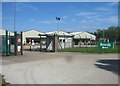
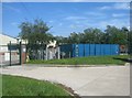
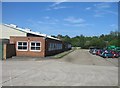
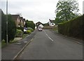
100 photos from this area
Area Information
Key information about the GU15 2SD including its size, population, and administrative classification.
- Area Type
- Postcode
- Area Size
- 1.4 hectares
- Population
- 1715
- Population Density
- 2888 people/km²
House Prices in GU15 2SD
28
Properties
£273,847
Average Sold Price
£70,950
Lowest Price
£510,000
Highest Price
Showing 28 properties
| Address | Type | Beds | Baths | Last Sale Price | Last Sale Date | |
|---|---|---|---|---|---|---|
| 17 Rivermead Road, Camberley, GU15 2SD | Semi-detached | 3 | 1 | £470,000 | Dec 2022 | |
| 53 Rivermead Road, Camberley, GU15 2SD | Semi-detached | 3 | - | £412,500 | Dec 2021 | |
| 1 Rivermead Road, Camberley, GU15 2SD | Semi-detached | 3 | 1 | £395,000 | Apr 2021 | |
| 35 Rivermead Road, Camberley, GU15 2SD | Semi-detached | 4 | 3 | £510,000 | Mar 2021 | |
| 21 Rivermead Road, Camberley, GU15 2SD | Semi-detached | - | - | £350,000 | May 2020 | |
| 13 Rivermead Road, Camberley, GU15 2SD | Semi-detached | 3 | - | £376,000 | Apr 2019 | |
| 15 Rivermead Road, Camberley, GU15 2SD | house | 4 | - | £400,000 | Mar 2017 | |
| 39 Rivermead Road, Camberley, GU15 2SD | house | - | - | £250,000 | Apr 2014 | |
| 37 Rivermead Road, Camberley, GU15 2SD | house | - | - | £212,000 | Dec 2012 | |
| 25 Rivermead Road, Camberley, GU15 2SD | Semi-detached | 3 | 1 | £130,000 | Jan 2009 |
Page 1 of 3
Energy Efficiency in GU15 2SD
Amenities
Schools
| Rank | School | Type | Entry gender | Ages |
|---|
Explore more schools in this area
Go to Schools tabDemographics
Household Size
Family (3-5 people)
most common
Accommodation Type
Houses
most common
Tenure
49
majority
Ethnic Group
White
most common
Religion
N/A
most common
Household Composition
N/A
most common
Age
47
median
Adults (30-64 years)
most common
Household Deprivation
N/A
with no deprivation
NS-SEC
27
in Lower managerial occupations
Explore more demographic insights in this area
Go to Demographics tabPlanning
Planning Constraints
- Flood RiskPremium
- Ramsar Wetland SitesPremium
- Area of Outstanding Natural BeautyPremium
- Protected Nature ReservePremium
- Protected WoodlandPremium