Area Overview for GU15 2RZ
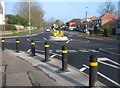
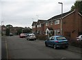
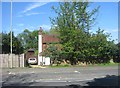
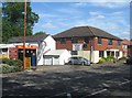
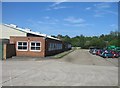
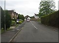
Photos of GU15 2RZ


Area Information
GU15 2RZ is a compact residential postcode in England, covering 3,655 square metres and home to 1,781 residents. Despite its small size, it is densely populated, with 487,332 people per square kilometre, reflecting a tightly knit community. The area is characterised by its mix of housing and proximity to essential services. Residents benefit from nearby schools, rail stations, and retail outlets, making it practical for daily life. The median age of 47 suggests a mature population, with a strong presence of adults aged 30–64. This demographic likely contributes to a stable, established neighbourhood. While the area is small, its strategic location offers access to amenities beyond its immediate bounds, such as Farnborough Airport and major retail hubs. However, the high population density means space is limited, and buyers should consider the area’s constraints when evaluating property options.
- Area Type
- Postcode
- Area Size
- 3655 m²
- Population
- 1781
- Population Density
- 2434 people/km²
GU15 2RZ is primarily an owner-occupied area, with 60% of homes owned by residents rather than rented. The accommodation type is predominantly houses, which is unusual for a small postcode but may reflect the area’s suburban character. Given the high population density and limited area size, the housing stock is constrained, making properties potentially competitive. Buyers should note that the area’s small footprint means fewer properties are available, and proximity to amenities like schools and rail stations is a key draw. However, the predominance of houses over flats or apartments may appeal to those seeking family-friendly or long-term housing. The market is likely to be niche, with demand driven by the area’s connectivity and local services rather than large-scale development.
House Prices in GU15 2RZ
Showing 10 properties
| Address | Type | Beds | Baths | Last Sale Price | Last Sale Date | |
|---|---|---|---|---|---|---|
| 32 Westfield Road, Camberley, GU15 2RZ | Detached | 3 | 1 | £443,000 | Nov 2024 | |
| 44 Westfield Road, Camberley, GU15 2RZ | Maisonette | 2 | 1 | £260,000 | Feb 2023 | |
| 30 Westfield Road, Camberley, GU15 2RZ | Semi-detached | 3 | 1 | £235,000 | Jun 2013 | |
| 38 Westfield Road, Camberley, GU15 2RZ | Flat | - | - | - | - | |
| 34 Westfield Road, Camberley, GU15 2RZ | house | - | - | - | - | |
| 42 Westfield Road, Camberley, GU15 2RZ | Flat | - | - | - | - | |
| 34A Westfield Road, Camberley, GU15 2RZ | house | - | - | - | - | |
| 36 Westfield Road, Camberley, GU15 2RZ | house | - | - | - | - | |
| 40 Westfield Road, Camberley, GU15 2RZ | Flat | - | - | - | - | |
| 28 Westfield Road, Camberley, GU15 2RZ | Semi-detached | - | - | - | - |
Energy Efficiency in GU15 2RZ
Residents of GU15 2RZ enjoy a range of amenities within walking or short driving distance. Retail options include Sainsburys Watchmoor, Asda Frimley, and Co-op Camberley, providing everyday shopping convenience. The proximity to rail stations and airports enhances mobility, making it practical for both local travel and regional or international trips. While the area is small, the availability of these services suggests a focus on practicality over leisure. The absence of detailed data on parks or leisure facilities means the area’s recreational options are unclear, but the presence of schools and retail suggests a community-oriented lifestyle. The compact nature of the postcode means amenities are concentrated, which can be both a convenience and a limitation depending on individual needs.
Amenities
Schools
Residents of GU15 2RZ have access to three primary schools within practical reach. South Camberley Primary & Nursery School and Watchetts Junior School cater to younger children, while South Camberley Primary and Nursery School holds an Ofsted rating of 'good'. This mix of schools provides families with options for early education, though the data does not mention secondary schools. The presence of a 'good' rated primary school suggests a baseline of quality in local education, but parents may need to look further afield for secondary schooling. The concentration of primary schools indicates the area’s focus on family living, with education a key consideration for homebuyers prioritising proximity to schools.
| Rank | School | Type | Entry gender | Ages |
|---|
Explore more schools in this area
Go to Schools tabDemographics
The community in GU15 2RZ is predominantly composed of adults aged 30–64, with a median age of 47. This suggests a mature population, likely with established careers and families. Home ownership is high, at 60%, with houses being the primary accommodation type. The predominant ethnic group is White, which aligns with broader regional trends. The population density of 487,332 people per square kilometre indicates a closely packed community, which may influence social dynamics and local services. While the data does not specify deprivation levels, the high home ownership rate and age profile suggest a relatively stable, middle-income demographic. However, the density could mean limited green space or pressure on local infrastructure, which prospective buyers should consider when assessing quality of life.
Household Size
Accommodation Type
Tenure
Ethnic Group
Religion
Household Composition
Age
Household Deprivation
NS-SEC
Explore more demographic insights in this area
Go to Demographics tabPlanning
Planning Constraints
- Flood RiskPremium
- Ramsar Wetland SitesPremium
- Area of Outstanding Natural BeautyPremium
- Protected Nature ReservePremium
- Protected WoodlandPremium