Area Overview for GU15 2LF
Photos of GU15 2LF
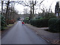

28 photos from this area
Area Information
Key information about the GU15 2LF including its size, population, and administrative classification.
- Area Type
- Postcode
- Area Size
- 10.6 hectares
- Population
- 2010
- Population Density
- 1757 people/km²
House Prices in GU15 2LF
31
Properties
£896,714
Average Sold Price
£425,000
Lowest Price
£1,747,000
Highest Price
Showing 31 properties
| Address | Type | Beds | Baths | Last Sale Price | Last Sale Date | |
|---|---|---|---|---|---|---|
| 26 Tekels Park, Camberley, GU15 2LF | Detached | 5 | 3 | £805,000 | May 2025 | |
| 7, Tekels Court, Tekels Park, Camberley, GU15 2LF | Flat | 2 | 1 | £425,000 | Aug 2023 | |
| 4 Tekels Park, Camberley, GU15 2LF | Semi-detached | 4 | 4 | £1,747,000 | Aug 2021 | |
| 14 Tekels Park, Camberley, GU15 2LF | Bungalow | 2 | 1 | £655,000 | Oct 2020 | |
| The White House, 12 Tekels Park, Camberley, GU15 2LF | Detached | - | - | £1,250,000 | Jul 2007 | |
| 16B Tekels Park, Camberley, GU15 2LF | Detached | 2 | 1 | £645,000 | Nov 2001 | |
| Wychwood, 16 Tekels Park, Camberley, GU15 2LF | Detached | 5 | 3 | £750,000 | Jul 2001 | |
| Flat 10, St Francis House, 18 Tekels Park, Camberley, GU15 2LF | Flat | 2 | 2 | - | - | |
| Flat 2, St Francis House, 18 Tekels Park, Camberley, GU15 2LF | Flat | 2 | 2 | - | - | |
| Flat 5, St Francis House, 18 Tekels Park, Camberley, GU15 2LF | Flat | 4 | 4 | - | - |
Page 1 of 4
Energy Efficiency in GU15 2LF
Amenities
Schools
| Rank | School | Type | Entry gender | Ages |
|---|
Explore more schools in this area
Go to Schools tabDemographics
Household Size
One person
most common
Accommodation Type
Flats
most common
Tenure
55
majority
Ethnic Group
White
most common
Religion
N/A
most common
Household Composition
N/A
most common
Age
47
median
Adults (30-64 years)
most common
Household Deprivation
N/A
with no deprivation
NS-SEC
42
in Lower managerial occupations
Explore more demographic insights in this area
Go to Demographics tabPlanning
Planning Constraints
- Flood RiskPremium
- Ramsar Wetland SitesPremium
- Area of Outstanding Natural BeautyPremium
- Protected Nature ReservePremium
- Protected WoodlandPremium