Area Overview for GU15 2DS
Photos of GU15 2DS
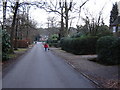
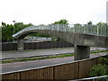
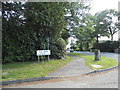
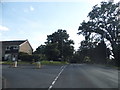


28 photos from this area
Area Information
Key information about the GU15 2DS including its size, population, and administrative classification.
- Area Type
- Postcode
- Area Size
- 6.7 hectares
- Population
- 1367
- Population Density
- 2211 people/km²
House Prices in GU15 2DS
52
Properties
£724,545
Average Sold Price
£200,000
Lowest Price
£1,700,000
Highest Price
Showing 52 properties
| Address | Type | Beds | Baths | Last Sale Price | Last Sale Date | |
|---|---|---|---|---|---|---|
| 30 Castle Road, Camberley, GU15 2DS | house | - | - | £900,000 | Dec 2024 | |
| 4 Castle Road, Camberley, GU15 2DS | Detached | 4 | 2 | £885,000 | Jul 2024 | |
| 3 Castle Road, Camberley, GU15 2DS | Detached | 7 | 3 | £1,250,000 | Feb 2024 | |
| 40 Castle Road, Camberley, GU15 2DS | Detached | 5 | 3 | £1,375,000 | Jul 2023 | |
| Voller Garden, 26 Castle Road, Camberley, GU15 2DS | Detached | 5 | 5 | £1,700,000 | Mar 2023 | |
| 22 Castle Road, Camberley, GU15 2DS | Detached | 6 | 3 | £1,570,000 | Dec 2022 | |
| 2 Castle Road, Camberley, GU15 2DS | house | - | - | £665,000 | Nov 2021 | |
| 7 Castle Road, Camberley, GU15 2DS | house | - | - | £1,200,000 | Sep 2021 | |
| 44 Castle Road, Camberley, GU15 2DS | Detached | 5 | 2 | £805,000 | Mar 2020 | |
| 13A Castle Road, Camberley, GU15 2DS | Cottage | 3 | 1 | £414,000 | Sep 2019 |
Page 1 of 6
Energy Efficiency in GU15 2DS
Amenities
Schools
| Rank | School | Type | Entry gender | Ages |
|---|
Explore more schools in this area
Go to Schools tabDemographics
Household Size
Family (3-5 people)
most common
Accommodation Type
Houses
most common
Tenure
91
majority
Ethnic Group
White
most common
Religion
N/A
most common
Household Composition
N/A
most common
Age
47
median
Adults (30-64 years)
most common
Household Deprivation
N/A
with no deprivation
NS-SEC
54
in Lower managerial occupations
Explore more demographic insights in this area
Go to Demographics tabPlanning
Planning Constraints
- Flood RiskPremium
- Ramsar Wetland SitesPremium
- Area of Outstanding Natural BeautyPremium
- Protected Nature ReservePremium
- Protected WoodlandPremium