Area Overview for GU14 9US
Photos of GU14 9US
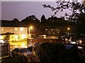
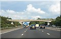
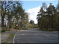
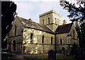
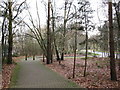

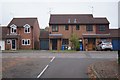
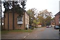
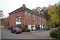
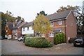
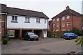
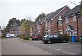
53 photos from this area
Area Information
Key information about the GU14 9US including its size, population, and administrative classification.
- Area Type
- Postcode
- Area Size
- 6752 m²
- Population
- 2477
- Population Density
- 6113 people/km²
House Prices in GU14 9US
25
Properties
£201,094
Average Sold Price
£72,000
Lowest Price
£352,500
Highest Price
Showing 25 properties
| Address | Type | Beds | Baths | Last Sale Price | Last Sale Date | |
|---|---|---|---|---|---|---|
| 5 Melrose Close, Farnborough, GU14 9US | Semi-detached | 2 | 1 | £352,500 | Aug 2022 | |
| 25 Melrose Close, Farnborough, GU14 9US | Semi-detached | 3 | 1 | £345,000 | Feb 2021 | |
| 6 Melrose Close, Farnborough, GU14 9US | Semi-detached | 2 | 1 | £300,000 | Jul 2020 | |
| 20 Melrose Close, Farnborough, GU14 9US | Detached | 3 | 1 | £186,000 | Aug 2018 | |
| 2 Melrose Close, Farnborough, GU14 9US | Semi-detached | 3 | 3 | £168,750 | Sep 2016 | |
| 19 Melrose Close, Farnborough, GU14 9US | house | - | - | £82,000 | Jan 2012 | |
| 14 Melrose Close, Farnborough, GU14 9US | house | - | - | £72,000 | Nov 2006 | |
| 1 Melrose Close, Farnborough, GU14 9US | Semi-detached | - | - | £102,500 | Jun 2006 | |
| 18 Melrose Close, Farnborough, GU14 9US | Terraced | 4 | 2 | - | - | |
| 24 Melrose Close, Farnborough, GU14 9US | Semi-detached | 3 | - | - | - |
Page 1 of 3
Energy Efficiency in GU14 9US
Amenities
Schools
| Rank | School | Type | Entry gender | Ages |
|---|
Explore more schools in this area
Go to Schools tabDemographics
Household Size
Family (3-5 people)
most common
Accommodation Type
Houses
most common
Tenure
68
majority
Ethnic Group
White
most common
Religion
N/A
most common
Household Composition
N/A
most common
Age
47
median
Adults (30-64 years)
most common
Household Deprivation
N/A
with no deprivation
NS-SEC
36
in Lower managerial occupations
Explore more demographic insights in this area
Go to Demographics tabPlanning
Planning Constraints
- Flood RiskPremium
- Ramsar Wetland SitesPremium
- Area of Outstanding Natural BeautyPremium
- Protected Nature ReservePremium
- Protected WoodlandPremium