Area Overview for GU14 9QN
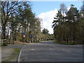
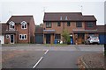
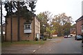
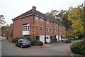
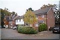
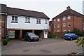
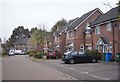
Photos of GU14 9QN


Area Information
Living in GU14 9QN means being part of a tightly knit residential cluster in England, where 1,735 people reside across just 2,809 square metres. This makes it one of the most densely populated areas in the country, with 617,738 people per square kilometre. Despite its compact size, the area offers a mix of practicality and accessibility. Its proximity to major retail hubs like Morrisons Rafborough, Co-op Cove, and Tesco Farnborough ensures daily errands are straightforward. Residents benefit from strong rail links, including Farnborough Railway Station and Frimley Railway Station, which connect to broader networks. The area’s high broadband score of 99 and mobile coverage of 83 support seamless digital connectivity, ideal for remote work or online services. With a median age of 47 and a population skewed toward adults aged 30–64, GU14 9QN reflects a mature, stable community. Its low crime risk and absence of environmental constraints make it a practical choice for those prioritising safety and convenience without sacrificing proximity to amenities.
- Area Type
- Postcode
- Area Size
- 2809 m²
- Population
- 1735
- Population Density
- 5196 people/km²
The property market in GU14 9QN is characterised by a high rate of home ownership, with 79% of residents living in houses. This indicates a market skewed toward owner-occupied properties rather than rental units, suggesting stability and long-term investment. The predominance of houses over flats or apartments reflects a preference for family-friendly, spacious living. Given the area’s small size and high density, housing stock is limited, which may drive demand for properties in the immediate vicinity. Buyers should consider that the market is likely competitive, with fewer options available. The focus on homes rather than rental properties also implies a community of settled residents, which could influence local amenities and services. For those seeking a property in GU14 9QN, the emphasis on houses may align with needs for space and privacy, though availability will be constrained by the area’s compact footprint.
House Prices in GU14 9QN
Showing 9 properties
| Address | Type | Beds | Baths | Last Sale Price | Last Sale Date | |
|---|---|---|---|---|---|---|
| 64A Minley Road, Farnborough, GU14 9QN | Detached | 3 | 2 | £420,000 | Mar 2024 | |
| 66 Minley Road, Farnborough, GU14 9QN | Semi-detached | 2 | - | £250,000 | Dec 2013 | |
| 78 Minley Road, Farnborough, GU14 9QN | Semi-detached | - | - | £235,000 | Nov 2006 | |
| 68A Minley Road, Farnborough, GU14 9QN | house | - | - | £164,000 | Jun 2001 | |
| 70 Minley Road, Farnborough, GU14 9QN | Semi-detached | - | - | £68,500 | Nov 1996 | |
| 76 Minley Road, Farnborough, GU14 9QN | Semi-detached | - | - | - | - | |
| 72 Minley Road, Farnborough, GU14 9QN | Semi-detached | - | - | - | - | |
| 74 Minley Road, Farnborough, GU14 9QN | Detached | - | - | - | - | |
| 68 Minley Road, Farnborough, GU14 9QN | Semi-detached | - | - | - | - |
Energy Efficiency in GU14 9QN
Residents of GU14 9QN have access to a range of practical amenities within reach. Retail options include Morrisons Rafborough, Co-op Cove, and Tesco Farnborough, providing grocery and daily shopping convenience. The area’s rail stations—Farnborough, Farnborough North, and Frimley—offer easy access to regional transport networks, while nearby airports like Farnborough and Blackbushe cater to those requiring air travel. Though the data does not mention parks or leisure facilities, the presence of multiple retail and transport hubs suggests a focus on functionality over leisure. The compact nature of the area means amenities are closely clustered, reducing travel time for essentials. This setup supports a lifestyle prioritising efficiency, with residents able to manage daily needs without long commutes. The combination of retail, rail, and air connectivity ensures a practical, accessible environment for everyday living.
Amenities
Schools
| Rank | School | Type | Entry gender | Ages |
|---|
Explore more schools in this area
Go to Schools tabDemographics
GU14 9QN is home to a predominantly adult population, with 79% of residents owning their homes and 79% of properties being houses. The median age of 47 indicates a mature demographic, with the most common age range being 30–64 years. This suggests a community of established professionals and families, likely seeking stability. The area’s predominant ethnic group is White, reflecting a homogenous demographic profile. With a population density of 617,738 people per square kilometre, the area is intensely populated, though its small size means residents are closely connected. The high home ownership rate implies long-term residency, contributing to a sense of continuity. However, the lack of specific data on deprivation or diversity means the area’s social dynamics are defined by its core demographic. For buyers, this profile suggests a community focused on practical living, with limited scope for rapid demographic change.
Household Size
Accommodation Type
Tenure
Ethnic Group
Religion
Household Composition
Age
Household Deprivation
NS-SEC
Explore more demographic insights in this area
Go to Demographics tabPlanning
Planning Constraints
- Flood RiskPremium
- Ramsar Wetland SitesPremium
- Area of Outstanding Natural BeautyPremium
- Protected Nature ReservePremium
- Protected WoodlandPremium