Area Overview for GU14 8SE
Photos of GU14 8SE
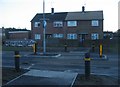

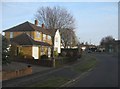
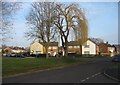
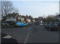
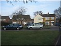
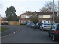
100 photos from this area
Area Information
Key information about the GU14 8SE including its size, population, and administrative classification.
- Area Type
- Postcode
- Area Size
- 1.0 hectares
- Population
- 1981
- Population Density
- 5017 people/km²
House Prices in GU14 8SE
22
Properties
£246,500
Average Sold Price
£79,000
Lowest Price
£450,000
Highest Price
Showing 22 properties
| Address | Type | Beds | Baths | Last Sale Price | Last Sale Date | |
|---|---|---|---|---|---|---|
| 116 Cheyne Way, Farnborough, GU14 8SE | Semi-detached | 3 | 1 | £450,000 | Nov 2023 | |
| 118 Cheyne Way, Farnborough, GU14 8SE | Semi-detached | 3 | 1 | £440,000 | Nov 2022 | |
| 197 Cheyne Way, Farnborough, GU14 8SE | Semi-detached | 3 | 2 | £325,000 | Oct 2021 | |
| 209 Cheyne Way, Farnborough, GU14 8SE | Flat | 2 | 1 | £247,000 | Jun 2021 | |
| 126 Cheyne Way, Farnborough, GU14 8SE | Semi-detached | 3 | 1 | £307,000 | Feb 2019 | |
| 181 Cheyne Way, Farnborough, GU14 8SE | Semi-detached | 3 | - | £286,000 | May 2015 | |
| 211 Cheyne Way, Farnborough, GU14 8SE | Maisonette | 2 | 1 | £140,000 | Oct 2008 | |
| 191 Cheyne Way, Farnborough, GU14 8SE | house | 3 | - | £168,000 | Apr 2004 | |
| 124 Cheyne Way, Farnborough, GU14 8SE | Semi-detached | - | - | £126,500 | Sep 2001 | |
| 205 Cheyne Way, Farnborough, GU14 8SE | Maisonette | - | - | £79,000 | Aug 2001 |
Page 1 of 3
Energy Efficiency in GU14 8SE
Amenities
Schools
| Rank | School | Type | Entry gender | Ages |
|---|
Explore more schools in this area
Go to Schools tabDemographics
Household Size
Family (3-5 people)
most common
Accommodation Type
Houses
most common
Tenure
68
majority
Ethnic Group
White
most common
Religion
N/A
most common
Household Composition
N/A
most common
Age
47
median
Adults (30-64 years)
most common
Household Deprivation
N/A
with no deprivation
NS-SEC
28
in Lower managerial occupations
Explore more demographic insights in this area
Go to Demographics tabPlanning
Planning Constraints
- Flood RiskPremium
- Ramsar Wetland SitesPremium
- Area of Outstanding Natural BeautyPremium
- Protected Nature ReservePremium
- Protected WoodlandPremium