Area Overview for GU14 8RT
Photos of GU14 8RT


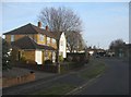
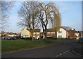
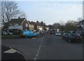
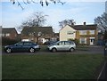
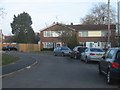
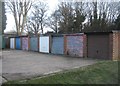
100 photos from this area
Area Information
Key information about the GU14 8RT including its size, population, and administrative classification.
- Area Type
- Postcode
- Area Size
- 1.2 hectares
- Population
- 1981
- Population Density
- 5017 people/km²
House Prices in GU14 8RT
25
Properties
£257,004
Average Sold Price
£121,500
Lowest Price
£425,000
Highest Price
Showing 25 properties
| Address | Type | Beds | Baths | Last Sale Price | Last Sale Date | |
|---|---|---|---|---|---|---|
| 11 Lynn Way, Farnborough, GU14 8RT | Semi-detached | 3 | 1 | £425,000 | Feb 2024 | |
| 2 Lynn Way, Farnborough, GU14 8RT | Semi-detached | 3 | 1 | £390,000 | Oct 2018 | |
| 25 Lynn Way, Farnborough, GU14 8RT | Semi-detached | 4 | 1 | £365,000 | Feb 2018 | |
| 3 Lynn Way, Farnborough, GU14 8RT | Semi-detached | 3 | - | £334,000 | Mar 2016 | |
| 8 Lynn Way, Farnborough, GU14 8RT | Semi-detached | 2 | - | £267,500 | Apr 2015 | |
| 9 Lynn Way, Farnborough, GU14 8RT | house | 4 | - | £200,000 | Sep 2011 | |
| 1 Lynn Way, Farnborough, GU14 8RT | Semi-detached | 3 | 1 | £225,000 | Sep 2011 | |
| 10 Lynn Way, Farnborough, GU14 8RT | Semi-detached | - | - | £270,000 | Mar 2008 | |
| 16 Lynn Way, Farnborough, GU14 8RT | Semi-detached | - | - | £248,000 | Oct 2007 | |
| 20 Lynn Way, Farnborough, GU14 8RT | Semi-detached | - | - | £233,000 | Aug 2007 |
Page 1 of 3
Energy Efficiency in GU14 8RT
Amenities
Schools
| Rank | School | Type | Entry gender | Ages |
|---|
Explore more schools in this area
Go to Schools tabDemographics
Household Size
Family (3-5 people)
most common
Accommodation Type
Houses
most common
Tenure
68
majority
Ethnic Group
White
most common
Religion
N/A
most common
Household Composition
N/A
most common
Age
47
median
Adults (30-64 years)
most common
Household Deprivation
N/A
with no deprivation
NS-SEC
28
in Lower managerial occupations
Explore more demographic insights in this area
Go to Demographics tabPlanning
Planning Constraints
- Flood RiskPremium
- Ramsar Wetland SitesPremium
- Area of Outstanding Natural BeautyPremium
- Protected Nature ReservePremium
- Protected WoodlandPremium