Area Overview for GU14 8RA
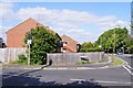
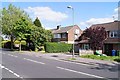
Photos of GU14 8RA


Area Information
Living in GU14 8RA means being part of a tightly packed residential cluster in England, where 1,362 people reside across just 3,038 square metres. This high population density creates a compact, closely knit community, though the area’s small size means amenities and services are concentrated. The postcode sits near Farnborough, offering proximity to retail, transport, and leisure hubs. Daily life here is shaped by its proximity to key infrastructure: multiple railway stations, nearby airports, and a mix of local shops. While the area lacks expansive green spaces, its strategic location ensures residents have access to broader regional amenities. The demographic profile—primarily adults aged 30–64, with 87% owning their homes—suggests a stable, established population. For buyers, this is a place where convenience and connectivity outweigh space, ideal for those prioritising accessibility over sprawling landscapes.
- Area Type
- Postcode
- Area Size
- 3038 m²
- Population
- 1362
- Population Density
- 4050 people/km²
The property market in GU14 8RA is dominated by owner-occupied homes, with 87% of properties owned by residents rather than rented. This indicates a stable, long-term demographic, with little turnover in the housing stock. The area’s accommodation is predominantly houses, which is unusual for a small postcode but suggests a focus on family-friendly or larger dwellings. Given the high population density and limited area size, the housing stock is likely constrained, making this a niche market for buyers seeking specific properties. The proximity to Farnborough and its amenities may attract those prioritising convenience over space, though the small size of GU14 8RA means the immediate surroundings are critical for additional options. Buyers should consider the area’s compact nature when evaluating property availability and potential future growth.
House Prices in GU14 8RA
Showing 4 properties
| Address | Type | Beds | Baths | Last Sale Price | Last Sale Date | |
|---|---|---|---|---|---|---|
| 3, Bridge Court, West Heath Road, Farnborough, GU14 8RA | Flat | - | - | £171,000 | Mar 2019 | |
| 2, Bridge Court, West Heath Road, Farnborough, GU14 8RA | Maisonette | 2 | - | £186,000 | Feb 2016 | |
| 4, Bridge Court, West Heath Road, Farnborough, GU14 8RA | Flat | - | - | £57,950 | Jun 1998 | |
| 1, Bridge Court, West Heath Road, Farnborough, GU14 8RA | Flat | - | - | £45,500 | Aug 1995 |
Energy Efficiency in GU14 8RA
Residents of GU14 8RA have access to a range of nearby amenities, including five retail outlets such as Tesco Farnborough, Morrisons Rafborough, and Lidl Farnborough. These stores provide convenience for daily shopping, though the area’s compact size means these are the primary retail options. The proximity to multiple railway stations—Farnborough, Farnborough North, and Frimley—ensures easy access to broader regional networks. Nearby airports, including Farnborough Airport and Blackbushe Airport, cater to those requiring air travel. While the data does not mention parks or leisure facilities, the area’s small size and high density suggest that residents may rely on nearby towns for larger recreational spaces. The mix of retail, transport, and regional connectivity creates a practical lifestyle, though the lack of detailed information on leisure options means buyers should investigate further for comprehensive needs.
Amenities
Schools
The nearest school to GU14 8RA is Cove Junior School, a primary institution with a ‘good’ Ofsted rating. This provides a reliable option for families requiring primary education, though no secondary schools are listed in the data. The presence of a single primary school suggests that families may need to travel to nearby areas for secondary schooling, which could be a factor for those prioritising a full range of educational facilities. The ‘good’ rating indicates a satisfactory standard of teaching and resources, but parents should verify if the school meets their specific needs. For buyers, the availability of a rated primary school is a positive, though the absence of secondary options may necessitate planning for longer commutes or alternative schooling arrangements.
| Rank | School | Type | Entry gender | Ages |
|---|
Explore more schools in this area
Go to Schools tabDemographics
GU14 8RA’s population of 1,362 is dominated by adults aged 30–64, with a median age of 47. This reflects a mature, settled community where 87% of residents own their homes, a figure significantly higher than the national average. The area is predominantly composed of houses, indicating a preference for single-family dwellings over flats. The predominant ethnic group is White, with no specific data on diversity beyond this. The population density of 448,367 people per square kilometre is exceptionally high, suggesting a compact, densely populated environment. This density may influence the character of daily life, fostering a sense of familiarity among residents while potentially limiting personal space. For buyers, the high home ownership rate and age profile suggest a market skewed towards long-term residents rather than transient populations.
Household Size
Accommodation Type
Tenure
Ethnic Group
Religion
Household Composition
Age
Household Deprivation
NS-SEC
Explore more demographic insights in this area
Go to Demographics tabPlanning
Planning Constraints
- Flood RiskPremium
- Ramsar Wetland SitesPremium
- Area of Outstanding Natural BeautyPremium
- Protected Nature ReservePremium
- Protected WoodlandPremium