Area Overview for GU14 8QH
Photos of GU14 8QH
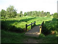
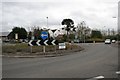
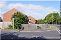
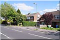
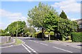

68 photos from this area
Area Information
Key information about the GU14 8QH including its size, population, and administrative classification.
- Area Type
- Postcode
- Area Size
- 1.3 hectares
- Population
- 1362
- Population Density
- 4050 people/km²
House Prices in GU14 8QH
26
Properties
£282,360
Average Sold Price
£64,500
Lowest Price
£455,750
Highest Price
Showing 26 properties
| Address | Type | Beds | Baths | Last Sale Price | Last Sale Date | |
|---|---|---|---|---|---|---|
| 23 West Heath Road, Farnborough, GU14 8QH | Semi-detached | 3 | 1 | £455,750 | Dec 2024 | |
| 8 West Heath Road, Farnborough, GU14 8QH | Semi-detached | 3 | 1 | £390,000 | Jul 2024 | |
| 11 West Heath Road, Farnborough, GU14 8QH | house | - | - | £433,000 | Aug 2022 | |
| 4 West Heath Road, Farnborough, GU14 8QH | house | - | - | £395,000 | Mar 2021 | |
| 24 West Heath Road, Farnborough, GU14 8QH | Semi-detached | 3 | 1 | £373,500 | Feb 2019 | |
| 25 West Heath Road, Farnborough, GU14 8QH | Semi-detached | 3 | - | £385,000 | Mar 2018 | |
| 17 West Heath Road, Farnborough, GU14 8QH | house | - | - | £365,000 | Nov 2017 | |
| 15 West Heath Road, Farnborough, GU14 8QH | Semi-detached | 3 | - | £336,500 | Mar 2017 | |
| 9 West Heath Road, Farnborough, GU14 8QH | Semi-detached | 3 | - | £345,500 | Sep 2016 | |
| 19 West Heath Road, Farnborough, GU14 8QH | Semi-detached | 3 | 1 | £355,000 | Aug 2016 |
Page 1 of 3
Energy Efficiency in GU14 8QH
Amenities
Schools
| Rank | School | Type | Entry gender | Ages |
|---|
Explore more schools in this area
Go to Schools tabDemographics
Household Size
Family (3-5 people)
most common
Accommodation Type
Houses
most common
Tenure
87
majority
Ethnic Group
White
most common
Religion
N/A
most common
Household Composition
N/A
most common
Age
47
median
Adults (30-64 years)
most common
Household Deprivation
N/A
with no deprivation
NS-SEC
33
in Lower managerial occupations
Explore more demographic insights in this area
Go to Demographics tabPlanning
Planning Constraints
- Flood RiskPremium
- Ramsar Wetland SitesPremium
- Area of Outstanding Natural BeautyPremium
- Protected Nature ReservePremium
- Protected WoodlandPremium